
London
Description
Capital of the United Kingdom. All sorts of walks. The Thames Path runs right through the city center and you can hop on the London Eye after being fooled at the ticket counter and view forward and backward on your trail.
Trails in this region
Links
Facts
Reports
Guides and maps
Lodging
Organisations
Tour operators
GPS
Other
Books

Stanfords
United Kingdom
United Kingdom
- The Handy London Bensons Map & Guide
- The Handy London Map & Guide from Bensons MapGuides in their range of street plans of central London, in a handy A5 paperback format with descriptions and an index of essential sights and numerous other places of interest, main shopping streets and markets, plus parks and gardens, all graded according to their importance and popularity.Coverage... Read more

Stanfords
United Kingdom
United Kingdom
- DK Eyewitness Travel Guide London
- Whether you want to tread the footsteps of kings and queens in the royal palaces, catch a show in the vibrant West End theatre district, or sample the tantalizing array of street food from around the world, your DK Eyewitness travel guide makes sure you experience all that London has to offer.Every corner of London is brimming with personality.... Read more

Stanfords
United Kingdom
United Kingdom
- Time Out London For Londoners
- London for Londoners is the ultimate handbook to everyday life in the capital. Borough by borough, Time Out takes you through the London that tourists don`t see. Each area is dissected, by way of facts and figures (council tax, transport, schools, house prices, rents and so on) and by amenities (parks, markets, sports facilities, arts venues,... Read more

Stanfords
United Kingdom
United Kingdom
- DK Eyewitness Europe
- Your journey starts here. Featuring DK`s much-loved maps and illustrations, walks and information, plus all new, full-colour photography, this 100% updated guide to Europe brings you the best of this diverse continent in a brand-new, lightweight format.- full-colour photography, hand-drawn illustrations, and maps throughout - easy-to-follow... Read more

Stanfords
United Kingdom
United Kingdom
- Lost Art of Walking
- Walking was once the only way to get around but now we just walk to the bus stop, station or car. Or we walk as a lifestyle choice - trekking holidays, charity walks, urban explorations. Geoff Nicholson`s The Lost Art of Walking brings pedestrianism back to the centre of life by musing on his own walks, reflecting on writers, artists, musicians... Read more

Stanfords
United Kingdom
United Kingdom
- London`s Hidden Walks: Volume 3
- The streets of London are inexhaustible in the tales they have to tell. Following the success of Steven Millar`s first two volumes, London`s Hidden Walks Vol.3 introduces twelve new walks that will surprise and entertain the intrepid explorer. With this book in hand, readers can find the plaque to a Suffragette who was a master of Jui-Jitsu,... Read more

Stanfords
United Kingdom
United Kingdom
- Thames Valley - 20 Country Walks For All The Family
- An exciting new gift series of walking guides, aimed at the weekend, family walker. These small-format, portable hardback books have an attractive retro feel, with nostalgic line drawings and hand-drawn maps. Each of the 20 walks have been carefully selected to appeal to family walkers, most are circular and none are too strenuous. Each walk... Read more

Stanfords
United Kingdom
United Kingdom
- An Opinionated Guide: Escape London
- London is amazing. It’s also amazingly exhausting. If you’re longing to discover wild walks, sample farm-fresh food, soak up some seaside culture or simply breathe cleaner air, this opinionated little guide will tell you, in no uncertain terms, the best places to visit just a train ride away from central London. No car necessary. Sonya Barber... Read more

Stanfords
United Kingdom
United Kingdom
- Railway Walks: LNER
- In ”Railway Walks: LNER”, Jeff Vinter, consultant to the BBC`s ”Railway Walks” series, provides an indispensable guide to ten carefully selected railway paths converted from lines once owned by the London and North Eastern Railway. From the quiet byways of East Anglia to the dramatic scenery of the North Yorkshire coast and the moorlands of... Read more

Stanfords
United Kingdom
United Kingdom
- The Big Walks of London
- The Big Walks of London by John Merrill is a guidebook to the capitals major walking routes. London has an incredible variety of walks and trails, and this guidebook presents more than twenty long walks through the city, ranging from 7 to 150 miles, and includes the Thames Path, the London Loop and the Capital Ring. Each walk section is... Read more

Stanfords
United Kingdom
United Kingdom
- The Beatles in London Walk
- “The Beatles in London Walk” is the most literal way you can take a Magical Mystery Tour about arguably the greatest band of all time; John, Paul, George and Ringo lived in the centre of London in the sixties, at the height of Beatlemania.This guide will let you capture some of the excitement of the Beatles’ time in London, with places such as... Read more
Stanfords
United Kingdom
United Kingdom
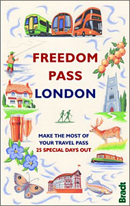
- Freedom Pass London
- Since its creation over 40 years ago, London`s Freedom Pass concessionary travel scheme has continued to grow in popularity and there are now over 1 million registered holders. Whether a fruit picker or forager, a rambler or angler, or simply someone who enjoys the quirky charm of a local pub, Bradt`s new Freedom Pass is the perfect read to... Read more

Stanfords
United Kingdom
United Kingdom
- DK Eyewitness Travel Guide London
- Discover the spectacular sights of a truly historic and cosmopolitan city with the DK Eyewitness Travel Guide: London 2017. Now includes five free audio walking tours. The best places to visit in London, from Buckingham Palace to the world renowned British Museum, are showcased with fantastic photography, illustrations, floorplans and... Read more

Stanfords
United Kingdom
United Kingdom
- London`s City Churches
- `London`s City Churches` include some of the Capital`s finest architecture. The sanctity of the church has prevented London s churches from being redeveloped or altered in any significant way and so they remain historical islands while the environment around them has changed beyond recognition. This guide is packed with information about the... Read more

Stanfords
United Kingdom
United Kingdom
- Sherlock Holmes Walk
- Step back in time and explore the London of Sherlock Holmes and Dr Watson. It is 1895 — a time of Hansom cabs rattling along cobbled streets, foggy lanes and gas-lit alleys, a romantic yet sinister London at the height of her Imperial greatness. Each site that is visited on this Walk has a major literary connection with our two heroes and their... Read more
Maps
Stanfords
United Kingdom
United Kingdom
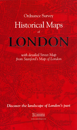
- London Historical Maps Box Set (5-map set)
- London Historical Set of five maps in the Cassini Historical Series reproducing old Ordnance Survey mapping of England and Wales at 1:50,000. The set consists of the four Cassini maps showing the capital between 1805 and 1948, and has as a bonus map a reproduction of Stanfords street plan London at six inches to one mile from 1891.The four... Read more

Stanfords
United Kingdom
United Kingdom
- London High 5 Edition Street Plan
- The first water-resistant “Comfort Map“ with direct access to useful additional information from the InternetLondon in a scale of 1:20,000 including tourist destinations (Hampstead Heath, Olympic Park and Greenwich) presented on a practical map; inclusive of the High 5 Edition app technology for calling up additional travel information and many... Read more

Stanfords
United Kingdom
United Kingdom
- London Greater London Street Finder PAPERBACK
- Detailed paperback street atlas covering the whole of Greater London at three different scales: 1:10,000 scale covers central London; 1:20,000 scale extends from Welwyn Garden City in the north to Gatwick Airport in the south and from Windsor in the west to Gravesend in the east; 1:63,360 scale extends from Highbury in the north to Clapham in... Read more

Stanfords
United Kingdom
United Kingdom
- London West 1920
- Map No. 176, London West 1920, in the Cassini Historical Series of old Ordnance Survey mapping of England and Wales at 1:50,000 in a format designed to offer a convenient comparison with the present day coverage from the OS, and most locations in three different editions. Old historical maps have been combined so that the sheet lines correspond... Read more

Stanfords
United Kingdom
United Kingdom
- London
- London at 1:50,00 with mapping from the Ordnance Survey’s Landranger series published by Cassini to add to their extensive coverage of the city on historical maps reflecting different periods in its development. Unlike the Landranger series which splits the city east/west, the Cassini version is centred on Charing Cross and covers most of the... Read more

Stanfords
United Kingdom
United Kingdom
- Ontario Southwestern: Brantford - London - Kitchener/Waterloo - Bruce Peninsula
- The south-western part of Ontario on a detailed, double-sided road map at 1:250,000 extending from Lake Erie to Lake Huron and the Bruce Peninsula, with five street plans at 1:25,000 covering central London, Windsor, Sarnia, Owen Sound and Stratford.Coverage of the region is divided between the two sides of the map, with a good overlap between... Read more

Stanfords
United Kingdom
United Kingdom
- Runners London in a Box: Beautiful running routes around London on individual handy, pocket-size cards
- 32 incredible running routes intelligently located all over Greater London. In this unique, boxed collection of folding, pocket-size cards you`ll find a variety of running routes around Greater London. Each card has a different route fully described and illustrated on a large scale, 1:25 000 map and include our carefully planned pitstops along... Read more
Stanfords
United Kingdom
United Kingdom
- London East 1920-1921
- Map No. 177, London East 1920-1921, in the Cassini Historical Series of old Ordnance Survey mapping of England and Wales at 1:50,000 in a format designed to offer a convenient comparison with the present day coverage from the OS, and most locations in three different editions. Old historical maps have been combined so that the sheet lines... Read more
Stanfords
United Kingdom
United Kingdom
- London West 1805-1920 (3-map set)
- Map No. 176, London West 1805-1920 (3-map set), in the Cassini Historical Series of old Ordnance Survey mapping of England and Wales at 1:50,000 in a format designed to offer a convenient comparison with the present day coverage from the OS, and most locations in three different editions. Old historical maps have been combined so that the sheet... Read more

Stanfords
United Kingdom
United Kingdom
- Luxembourg North
- One of two topographic survey maps of Luxembourg at 1:50,000, with contours at 10-metres intervals and additional relief shading. An overprint highlights long-distance footpaths, including the GR5 (E-2), cycle routes, and various places of interest, including campsites. The map covers an area of approximately 53 x 43 km / 33 x 27 miles. Map... Read more
Stanfords
United Kingdom
United Kingdom
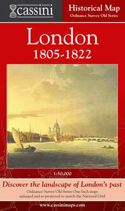
- London 1805-1822
- London in 1805-1822 in the Cassini Historical Series reproducing old Ordnance Survey mapping of England and Wales at 1:50,000. The four London maps cover roughly the area of the present day Greater London rather than following the format of rest of the series which is designed to correspond to the current Landranger maps. Mapping is identical... Read more
Stanfords
United Kingdom
United Kingdom
- London East 1805-1922 (3-map set)
- Map No. 177, London East 1805-1922 (3-map set), in the Cassini Historical Series of old Ordnance Survey mapping of England and Wales at 1:50,000 in a format designed to offer a convenient comparison with the present day coverage from the OS, and most locations in three different editions. Old historical maps have been combined so that the sheet... Read more

Stanfords
United Kingdom
United Kingdom
- Luxembourg South
- One of two topographic survey maps of Luxembourg at 1:50,000, with contours at 10-metres intervals and additional relief shading. An overprint highlights long-distance footpaths, including the GR5 (E-2), cycle routes, and various places of interest, including campsites. The map covers an area of approximately 53 x 43 km / 33 x 27 miles. Map... Read more
Stanfords
United Kingdom
United Kingdom
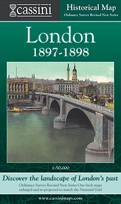
- London 1897-1898
- London in 1897-1898 in the Cassini Historical Series reproducing old Ordnance Survey mapping of England and Wales at 1:50,000. The four London maps cover roughly the area of the present day Greater London rather than following the format of rest of the series which is designed to correspond to the current Landranger maps. Mapping is identical... Read more

Stanfords
United Kingdom
United Kingdom
- Sonoma Valley Biking and Hiking Trails
- Sonoma Valley on a contoured hiking and biking map from Map Adventures showing local conservations areas, detailed classification of recreational trails, wineries, etc. On one side a map at 1:30,000 covers the northern part of the valley along the Sonoma Highway from Glen Ellen to Santa Rosa, including the Taylor Mountain Regional Park, Annadel... Read more