
Wales
Description
Map

Trails in this state
- All Wales Coast PathGPX
- Beacons WayGPX
- Cambrian Way
- Clwydian WayGPX
- Coed Morgannwg Way
- Dyfi Valley Way
- Glamorgan Ridgeway
- Glyndŵr's WayGPX
- Isle of Anglesey Coastal PathGPX
- Llŷn Coastal PathGPX
- North Wales PathGPX
- Offa's Dyke PathGPX
- Pembrokeshire Coast PathGPX
- Severn WayGPX
- Sirhowy Valley Walk
- Usk Valley WalkGPX
- Wye Valley WalkGPX
Links
Facts
Reports
Guides and maps
Lodging
Organisations
Tour operators
GPS
Other
Books

Stanfords
United Kingdom
United Kingdom
- North Wales - Best Walks
- Twenty-eight of the Finest Circular Walks in North Wales: Covering the Isle of Anglesey, Ileyn Peninsula, Northern Snowdonia and Northeast Wales Read more

Stanfords
United Kingdom
United Kingdom
- Curlew Moon
- `Focuses a razor light on the plight of one of our most iconic birds. Inspirational!` Tim Birkhead Curlews are Britain`s largest wading bird, known for their evocative calls which embody wild places; they provoke a range of emotions that many have expressed in poetry, art and music. ”A bird stands alone on the edge of a mudflat. Its silhouette... Read more

Stanfords
United Kingdom
2021
United Kingdom
2021
- Pocket Rough Guide Staycations Snowdonia & North Wales (Travel Guide with Free eBook)
- Rough Guides Staycations Snowdonia & North WalesMake the most of your time on Earth with the ultimate travel guides.Inspirational and informative new pocket guide, with free eBook, making the most of holidaying at home in the UK through clearly laid-out walks and tours.Explore the best of Snowdonia & North Wales with this unique travel guide,... Read more

Stanfords
United Kingdom
United Kingdom
- Britain`s Best Coastal Walks
- Accompanied by beautiful colour photography, ”Britain`s Best Coastal Walks” celebrates the varied treasures to be found on the coastlines of England, Wales and Scotland. Andrew McCloy has devised 15 two- to three-day walks along sections of Britain`s most famous coastal paths, which are shown on clear and detailed maps. His commentaries focus... Read more

Stanfords
United Kingdom
United Kingdom
- London A-Z Map & Walks
- A-Z London Map & Walks at 1:8,629 (7.33 inches to 1 mile) from Geographers` A-Z Map Company, highlighting the Jubilee Walkway and the Princess Diana Memorial Walk, with a bus map of central London, plus on the reverse map extracts with more walks with detailed descriptions.The map uses the same basic cartography as A-Z’s range of street atlases... Read more

Stanfords
United Kingdom
United Kingdom
- Wild Pub Walks
- Join the author on 30 walks in beautiful remote or mountain landscapes, each with a great pub - often with historical significance - at journey`s end. The book is aimed at the large market of hill walkers who enjoy long days out followed by a great pint in a great pub.The areas covered are: Peak District; Lake District; Highlands/Islands;... Read more

Stanfords
United Kingdom
United Kingdom
- Thinking on My Feet: The small joy of putting one foot in front of another
- Shortlisted for the 2019 Edward Stanford Travel Writing Award`s Travel Memoir of the Year`An enticing read that makes every walk Humble describes an adventure` - Ranulph Fiennes`A beautiful and magnificent book. A paean to a simple act. I defy you to read this book and not be inspired to walk, march or hike - and as a result live a better life... Read more

Stanfords
United Kingdom
2021
United Kingdom
2021
- DK Eyewitness Road Trips Great Britain
- With its idyllic market towns, romantic castle ruins and stunning natural landscapes, Great Britain is the perfect destination for a leisurely road trip. It`s yours to explore with Road Trips Great Britain, which contains 25 drives across the country, from the sweeping sandy beaches of Cornwall to the dramatic peaks of the Scottish... Read more

Stanfords
United Kingdom
United Kingdom
- Coastlines: The Story of Our Shore
- From one of the most engaging and widely admired of the new generation of nature writers, here is a portrait of the British coastline from the Giant`s Causeway to Land`s End.Told through a series of walks beside the sea, this is the story of the most beautiful 742 miles of coastline in England, Wales and Northern Ireland-its rocks, plants and... Read more

Stanfords
United Kingdom
United Kingdom
- The National Trust Book of the Countryside
- Explore the British countryside with the National Trust. No organisation knows more about the British countryside than the National Trust, the custodians of some of our most beautiful stretches of land and coastline. Drawing on their expertise, this stunningly illustrated book is a comprehensive guide to the country`s natural heritage. Part One... Read more

Stanfords
United Kingdom
United Kingdom
- The Great British Bucket List
- If you want to ski off a cliff or swim with sharks, stop reading now. This book is about achievable adventures that celebrate the best of Britain and Britishness. The 60 mini adventures are graded in difficulty from comically easy to mildly challenging, making them suitable for a wide range of ages and abilities. They include the most beautiful... Read more

Stanfords
United Kingdom
United Kingdom
- Walks for All Ages in North East Wales: 20 Short Walks for All the Family
- 20 Short Walks for All the Family Read more

Stanfords
United Kingdom
2019
United Kingdom
2019
- Snowdonia & North Wales: AA 50 Walks
- Walking is one of Britain`s favourite leisure activities, and AA 50 Walks in Snowdonia & North Wales features a variety of mapped walks of two to ten miles, to suit all abilities. The book features all the practical detail you need, accompanied by fascinating background reading on the history and wildlife in Snowdonia & North Wales, and clear... Read more

Stanfords
United Kingdom
United Kingdom
- Cardigan & Mynydd Preseli OS Landranger Active Map 145 (waterproof)
- The coast of Wales between Dinas Head and New Quay, including Cardigan and the northern part of the Pembrokeshire Coast National Park, on a waterproof and tear-resistant OS Active version of map No. 145 from the Ordnance Survey’s Landranger series at 1:50,000, with contoured and GPS compatible topographic mapping plus tourist information.MOBILE... Read more

Stanfords
United Kingdom
United Kingdom
- Wye Valley & Forest of Dean OS Explorer Active Map OL14 (waterproof)
- The Wye Valley and the Forest of Dean on a detailed topographic and GPS compatible map OL14, waterproof version, from the Ordnance Survey’s 1:25,000 Explorer series. Coverage extends from Chepstow in the south to beyond Ross-on-Wye and includes Monmouth, the Wye Valley Area of Outstanding Natural Beauty, sections of the Offa’s Dyke National... Read more
Maps

Stanfords
United Kingdom
United Kingdom
- Ely and Wisbech 1824-1836
- Map No. 143, Ely and Wisbech 1824-1836, in the Cassini Historical Series of old Ordnance Survey mapping of England and Wales at 1:50,000 in a format designed to offer a convenient comparison with the present day coverage from the OS, and most locations in three different editions. Old historical maps have been combined so that the sheet lines... Read more
Stanfords
United Kingdom
United Kingdom
- Gloucester and the Forest of Dean 1824-1831
- Map No. 162, Gloucester and the Forest of Dean 1824-1831, in the Cassini Historical Series of old Ordnance Survey mapping of England and Wales at 1:50,000 in a format designed to offer a convenient comparison with the present day coverage from the OS, and most locations in three different editions. Old historical maps have been combined so that... Read more
Stanfords
United Kingdom
United Kingdom
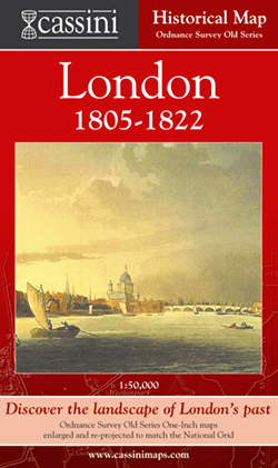
- London 1805-1822
- London in 1805-1822 in the Cassini Historical Series reproducing old Ordnance Survey mapping of England and Wales at 1:50,000. The four London maps cover roughly the area of the present day Greater London rather than following the format of rest of the series which is designed to correspond to the current Landranger maps. Mapping is identical... Read more
Stanfords
United Kingdom
United Kingdom
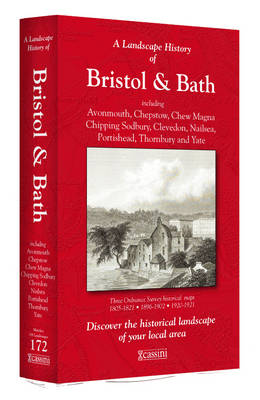
- Bristol and Bath 1817-1919 (3-map set)
- Map No. 172, Bristol and Bath 1899, in the Cassini Historical Series of old Ordnance Survey mapping of England and Wales at 1:50,000 in a format designed to offer a convenient comparison with the present day coverage from the OS, and most locations in three different editions. Old historical maps have been combined so that the sheet lines... Read more
Stanfords
United Kingdom
United Kingdom
- Vale of Glamorgan / Bro Morgannwg 1809-1833
- Map No. 170, Vale of Glamorgan / Bro Morgannwg 1809-1833, in the Cassini Historical Series of old Ordnance Survey mapping of England and Wales at 1:50,000 in a format designed to offer a convenient comparison with the present day coverage from the OS, and most locations in three different editions. Old historical maps have been combined so that... Read more
Stanfords
United Kingdom
United Kingdom
- Market Weighton 1924
- Map No. 106, Market Weighton 1924, in the Cassini Historical Series of old Ordnance Survey mapping of England and Wales at 1:50,000 in a format designed to offer a convenient comparison with the present day coverage from the OS, and most locations in three different editions. Old historical maps have been combined so that the sheet lines... Read more
Stanfords
United Kingdom
United Kingdom
- Chester and Wrexham / Caer a Wrecsam 1833-1843
- Map No. 117, Chester and Wrexham / Caer a Wrecsam 1833-1843, in the Cassini Historical Series of old Ordnance Survey mapping of England and Wales at 1:50,000 in a format designed to offer a convenient comparison with the present day coverage from the OS, and most locations in three different editions. Old historical maps have been combined so... Read more
Stanfords
United Kingdom
United Kingdom
- Colchester 1898
- Map No. 168, Colchester 1898, in the Cassini Historical Series of old Ordnance Survey mapping of England and Wales at 1:50,000 in a format designed to offer a convenient comparison with the present day coverage from the OS, and most locations in three different editions. Old historical maps have been combined so that the sheet lines correspond... Read more
Stanfords
United Kingdom
United Kingdom
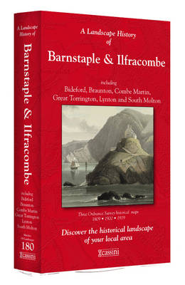
- Barnstaple and Ilfracombe 1809-1919 (3-map set)
- Map No. 180, Barnstaple and Ilfracombe 1809-1919 (3-map set), in the Cassini Historical Series of old Ordnance Survey mapping of England and Wales at 1:50,000 in a format designed to offer a convenient comparison with the present day coverage from the OS, and most locations in three different editions. Old historical maps have been combined so... Read more
Stanfords
United Kingdom
United Kingdom
- Newtown and Llanidloes / Y Drenewydd a Llanidloes 1833-1837
- Map No. 136, Newtown and Llanidloes / Y Drenewydd a Llanidloes 1833-1837, in the Cassini Historical Series of old Ordnance Survey mapping of England and Wales at 1:50,000 in a format designed to offer a convenient comparison with the present day coverage from the OS, and most locations in three different editions. Old historical maps have been... Read more
Stanfords
United Kingdom
United Kingdom
- Cheviot Hills and Kielder Water 1925-1926
- Map No. 80, Cheviot Hills and Kielder Water 1925-1926, in the Cassini Historical Series of old Ordnance Survey mapping of England and Wales at 1:50,000 in a format designed to offer a convenient comparison with the present day coverage from the OS, and most locations in three different editions. Old historical maps have been combined so that... Read more
Stanfords
United Kingdom
United Kingdom
- York and Selby 1824-1858
- Map No. 105, York and Selby 1840-1858, in the Cassini Historical Series of old Ordnance Survey mapping of England and Wales at 1:50,000 in a format designed to offer a convenient comparison with the present day coverage from the OS, and most locations in three different editions. Old historical maps have been combined so that the sheet lines... Read more
Stanfords
United Kingdom
United Kingdom
- Derby and Burton upon Trent 1834-1839
- Map No. 128, Derby and Burton upon Trent 1834-1839, in the Cassini Historical Series of old Ordnance Survey mapping of England and Wales at 1:50,000 in a format designed to offer a convenient comparison with the present day coverage from the OS, and most locations in three different editions. Old historical maps have been combined so that the... Read more
Stanfords
United Kingdom
United Kingdom
- Chichester and the South Downs 1897-1900
- Map No. 197, Chichester and the South Downs 1897-1900, in the Cassini Historical Series of old Ordnance Survey mapping of England and Wales at 1:50,000 in a format designed to offer a convenient comparison with the present day coverage from the OS, and most locations in three different editions. Old historical maps have been combined so that... Read more

Stanfords
United Kingdom
United Kingdom
- Ashford and Romney Marsh 1813-1923 (3-map set)
- Map No. 189, Ashford and Romney Marsh 1813-1923 (3-map set), in the Cassini Historical Series of old Ordnance Survey mapping of England and Wales at 1:50,000 in a format designed to offer a convenient comparison with the present day coverage from the OS, and most locations in three different editions. Old historical maps have been combined so... Read more