
Gifford Pinchot National Forest
Description
Trails in this region
Links
Facts
Reports
Guides and maps
Lodging
Organisations
Tour operators
GPS
Other
Books

The Book Depository
United Kingdom
United Kingdom
- Pacific Crest Trail Data Book
- Mileages, Landmarks, Facilities, Resupply Data, and Essential Trail Information for the Entire Pacific Crest Trail, from Mexico to Canada Read more

The Book Depository
United Kingdom
United Kingdom
- Pacific Crest Trail, Washington North
- Topographic Map Guide Read more
The Book Depository
United Kingdom
United Kingdom
- Oregon Uncaged
- A Tale of Two-Sips on the Pacific Crest Trail Read more
The Book Depository
United Kingdom
United Kingdom

The Book Depository
United Kingdom
United Kingdom
- A Twisting Journey Continues
- Northern Oregon Backroads Guide to the PCT Read more


The Book Depository
United Kingdom
United Kingdom

The Book Depository
United Kingdom
United Kingdom
- A Twisting Journey
- Southern Oregon Backroads Guide to the PCT Read more

The Book Depository
United Kingdom
United Kingdom

The Book Depository
United Kingdom
United Kingdom

The Book Depository
United Kingdom
United Kingdom
- Pacific Crest Trail, The
- Hiking America's Wilderness Trail Read more

The Book Depository
United Kingdom
United Kingdom
- Pacific Crest Trail: Oregon & Washington
- From the California Border to Canada Read more
More books…
Maps

Stanfords
United Kingdom
United Kingdom
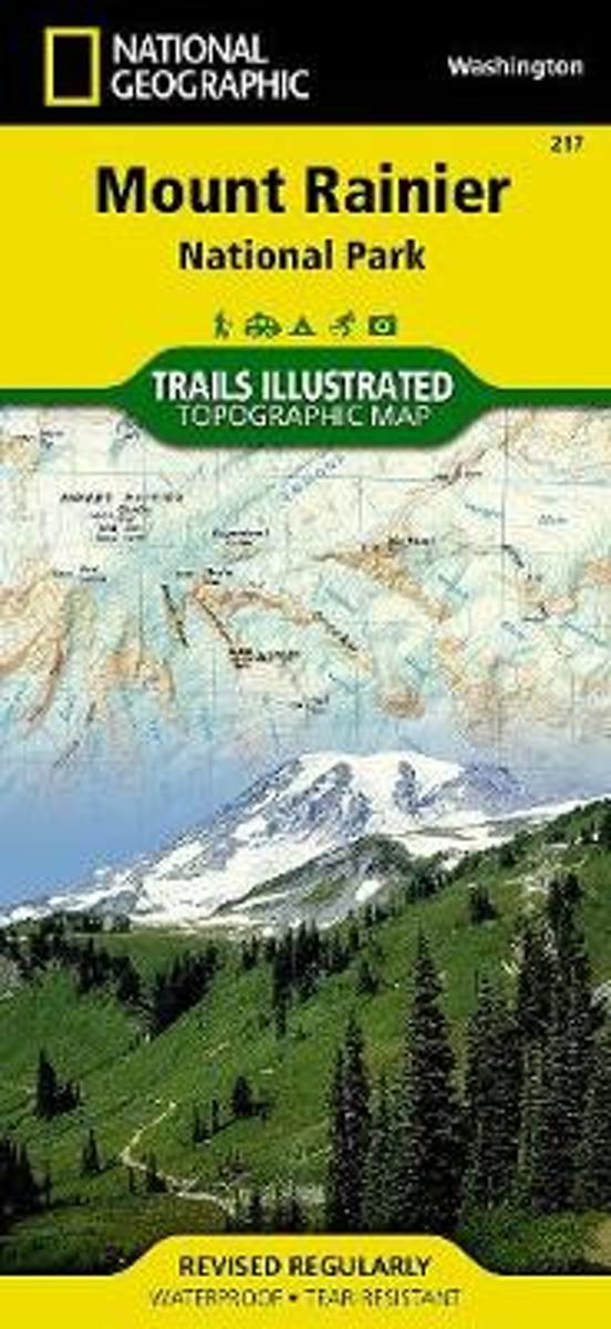
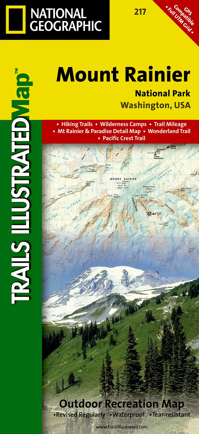
- Mount Rainier National Park WA
- Map No. 217, Mount Rainier National Park, WA, in an extensive series of GPS compatible, contoured hiking maps of USA’s national and state parks or forests and other popular recreational areas. Cartography based on the national topographic survey, with additional tourist information.The maps, with most titles now printed on light, waterproof and... Read more
- Also available from:
- The Book Depository, United Kingdom
- Bol.com, Netherlands
- Bol.com, Belgium
- De Zwerver, Netherlands

The Book Depository
United Kingdom
United Kingdom
- Mount Rainier National Park
- Trails Illustrated National Parks Read more
Bol.com
Netherlands
Netherlands
- Mount Rainier National Park
- Waterproof Tear-Resistant Topographic MapThe highest point in the Cascade Range, Mount Ranier is an icon of Washington state. It is an active volcano and the largest single-peak glacial system in the lower forty-eight states, spawning 6 major rivers. National Geographic's Trails Illustrated map of Mount Ranier National Park is designed to... Read more
Bol.com
Belgium
Belgium
- Mount Rainier National Park
- Waterproof Tear-Resistant Topographic MapThe highest point in the Cascade Range, Mount Ranier is an icon of Washington state. It is an active volcano and the largest single-peak glacial system in the lower forty-eight states, spawning 6 major rivers. National Geographic's Trails Illustrated map of Mount Ranier National Park is designed to... Read more
De Zwerver
Netherlands
Netherlands
- Wandelkaart - Topografische kaart 217 Mount Rainier National Park | National Geographic
- Prachtige geplastificeerde kaart van het bekende nationaal park. Met alle recreatieve voorzieningen als campsites, maar ook met topografische details en wandelroutes ed. Door uitgekiend kleurgebruik zeer prettig in gebruik. Scheur en watervast! Within the park, there is detailed coverage of Mount Rainier and its many glaciers, Eagles Roost,... Read more

Stanfords
United Kingdom
United Kingdom
- Alpine Lakes Wilderness - Mt Baker-Snoqualmie and Okanogan-Wenatchee National Forests WA
- Map No. 825, Alpine Lakes Wilderness Area - Mount Baker-Snoqualmie Wilderness Areas and Okanogan-Wenatchee National Forests, WA, in an extensive series of GPS compatible, contoured hiking maps of USA’s national and state parks or forests and other popular recreational areas. Cartography based on the national topographic survey, with additional... Read more
- Also available from:
- Bol.com, Netherlands
- Bol.com, Belgium

Bol.com
Netherlands
Netherlands
- Alpine Lakes Wilderness Area, Mount Baker-snoqualmie & Okanogan-wenatchee National Forests
- Waterproof Tear-Resistant Topographic MapMount Baker-Snoqualmie and Okanogan-Wenatchee National Forests Washington, USAOne of five new Trails Illustrated maps for the Washington Cascades region offering the most detailed and up-to-date map for the forest, carefully researched and developed in co-operation with local land managers and... Read more
Bol.com
Belgium
Belgium
- Alpine Lakes Wilderness Area, Mount Baker-snoqualmie & Okanogan-wenatchee National Forests
- Waterproof Tear-Resistant Topographic MapMount Baker-Snoqualmie and Okanogan-Wenatchee National Forests Washington, USAOne of five new Trails Illustrated maps for the Washington Cascades region offering the most detailed and up-to-date map for the forest, carefully researched and developed in co-operation with local land managers and... Read more

Stanfords
United Kingdom
United Kingdom
- Mount Whitney CA NGS Trails Illustrated Map 322
- Map No. 322, Mount Whitney in California at 1:40,000, in an extensive series of GPS compatible, contoured hiking maps of USA’s national and state parks or forests and other popular recreational areas. Cartography is based on the national topographic survey, with additional tourist information.The maps, with most titles now printed on light,... Read more
- Also available from:
- Bol.com, Netherlands
- Bol.com, Belgium

Bol.com
Netherlands
Netherlands
- Mount Whitney
- Waterproof Tear-Resistant Topographic MapMount Whitney is universally famous as the highest mountain in the United State outside of Alaska, as well as the highest point in California. National Geographic's Trails Illustrated map of Mount Whitney is a two-sided, waterproof map designed to meet the needs of Whitney visitors with unmatched... Read more
Bol.com
Belgium
Belgium
- Mount Whitney
- Waterproof Tear-Resistant Topographic MapMount Whitney is universally famous as the highest mountain in the United State outside of Alaska, as well as the highest point in California. National Geographic's Trails Illustrated map of Mount Whitney is a two-sided, waterproof map designed to meet the needs of Whitney visitors with unmatched... Read more

Stanfords
United Kingdom
United Kingdom
- Sequoia - Kings Canyon National Parks CA NGS Trails Illustrated Map 205
- Map No. 205, Sequoia/Kings Canyon National Park, CA, in an extensive series of GPS compatible, contoured hiking maps of USA’s national and state parks or forests and other popular recreational areas. Cartography based on the national topographic survey, with additional tourist information.The maps, with most titles now printed on light,... Read more
- Also available from:
- The Book Depository, United Kingdom
- Bol.com, Netherlands
- Bol.com, Belgium
- De Zwerver, Netherlands

The Book Depository
United Kingdom
United Kingdom
- Sequoia/kings Canyon National Park
- Trails Illustrated National Parks Read more

Bol.com
Netherlands
Netherlands
- Sequoia/kings Canyon National Park
- Waterproof Tear-Resistant Topographic MapIn Sequioa and Kings Canyon National Parks you can walk among the world's largest trees, hike the alpine landscape of the Sierra Crest, and marvel at the towering granite cliffs of one of the deepest canyons in the United States. National Geographic's Trails Illustrated map of Sequoia and Kings... Read more
Bol.com
Belgium
Belgium
- Sequoia/kings Canyon National Park
- Waterproof Tear-Resistant Topographic MapIn Sequioa and Kings Canyon National Parks you can walk among the world's largest trees, hike the alpine landscape of the Sierra Crest, and marvel at the towering granite cliffs of one of the deepest canyons in the United States. National Geographic's Trails Illustrated map of Sequoia and Kings... Read more

De Zwerver
Netherlands
Netherlands
- Wandelkaart - Topografische kaart 205 Sequoia - Kings Canyon National Parks | National Geographic
- Prachtige geplastificeerde kaart van het nationaal park. Met alle recreatieve voorzieningen als campsites, maar ook met topografische details en wandelroutes ed. Door uitgekiend kleurgebruik zeer prettig in gebruik. Scheur en watervast! Trails Illustrated maps are the most trusted and popular recreation maps available. Continually setting the... Read more

Stanfords
United Kingdom
United Kingdom
- Mammoth Lakes - Mono Divide CA
- Map No. 809, Mammoth Lakes / Mono Divide, CA, in an extensive series of GPS compatible, contoured hiking maps of USA’s national and state parks or forests and other popular recreational areas. Cartography based on the national topographic survey, with additional tourist information.The maps, with most titles now printed on light, waterproof and... Read more
- Also available from:
- Bol.com, Netherlands
- Bol.com, Belgium
- De Zwerver, Netherlands

Bol.com
Netherlands
Netherlands
- Mammoth Lakes/mono Divide
- Waterproof Tear-Resistant Topographic MapTrails Illustrated Mammoth Lakes / Mono Divide is the first of five exciting new maps for the California Sierra Nevadas that will combine to form seamless coverage of the high-use National Forest areas between Sequoia / Kings Canyon National Parks and Lake Tahoe. This region contains some of the... Read more
Bol.com
Belgium
Belgium
- Mammoth Lakes/mono Divide
- Waterproof Tear-Resistant Topographic MapTrails Illustrated Mammoth Lakes / Mono Divide is the first of five exciting new maps for the California Sierra Nevadas that will combine to form seamless coverage of the high-use National Forest areas between Sequoia / Kings Canyon National Parks and Lake Tahoe. This region contains some of the... Read more

De Zwerver
Netherlands
Netherlands
- Wandelkaart - Topografische kaart 809 Mammoth Lakes - Mono Divide - Inyo and Sierra National Forests | National Geographic
- Prachtige geplastificeerde kaart van het bekende nationaal park. Met alle recreatieve voorzieningen als campsites, maar ook met topografische details en wandelroutes ed. Door uitgekiend kleurgebruik zeer prettig in gebruik. Scheur en watervast! Trails Illustrated Mammoth Lakes / Mono Divide is the first of five exciting new maps for the... Read more

Stanfords
United Kingdom
United Kingdom
- Carson-Iceberg - Emigrant and Mokleumne Wilderness Areas CA
- Map No. 807, Carson-Iceberg / Emigrant / Mokleumne Wilderness Areas, CA, in an extensive series of GPS compatible, contoured hiking maps of USA’s national and state parks or forests and other popular recreational areas. Cartography based on the national topographic survey, with additional tourist information.The maps, with most titles now... Read more
- Also available from:
- Bol.com, Netherlands
- Bol.com, Belgium

Bol.com
Netherlands
Netherlands
- Carson-iceberg/emigrant/mokleumne Wilderness Areas
- Waterproof Tear-Resistant Topographic MapPart of our exciting new coverage for California's Sierra Nevada, our Carson-Iceberg, Emigrant and Mokelumne Wilderness Trails Illustrated map details the high use recreation areas of Stanislaus and Humboldt-Toiyabe National Forests from Yosemite National Park north to Caples Lake and Markleeville.... Read more
Bol.com
Belgium
Belgium
- Carson-iceberg/emigrant/mokleumne Wilderness Areas
- Waterproof Tear-Resistant Topographic MapPart of our exciting new coverage for California's Sierra Nevada, our Carson-Iceberg, Emigrant and Mokelumne Wilderness Trails Illustrated map details the high use recreation areas of Stanislaus and Humboldt-Toiyabe National Forests from Yosemite National Park north to Caples Lake and Markleeville.... Read more

Stanfords
United Kingdom
United Kingdom
- Goat Rocks - Norse Peak William O. Douglas Wilderness Area WA
- Map No. 823, Goat Rocks and Norse Peak Wilderness Area - Gifford-Pinchot and Okanogan-Wenatchee National Forests, WA, in an extensive series of GPS compatible, contoured hiking maps of USA’s national and state parks or forests and other popular recreational areas. Cartography based on the national topographic survey, with additional tourist... Read more
- Also available from:
- Bol.com, Netherlands
- Bol.com, Belgium

Bol.com
Netherlands
Netherlands
- Goat Rocks & Norse Peak Wilderness Area, Gifford-pinchot & Okanogan-wenatchee National Forests
- Waterproof Tear-Resistant Topographic MapGifford-Pinchot and Okanogan-Wenatchee National Forests Washington, USAOne of five new Trails Illustrated maps for the Washington Cascades region offers the most detailed and up-to-date map for the forest, carefully researched and developed in co-operation with local land managers and agencies.... Read more
Bol.com
Belgium
Belgium
- Goat Rocks & Norse Peak Wilderness Area, Gifford-pinchot & Okanogan-wenatchee National Forests
- Waterproof Tear-Resistant Topographic MapGifford-Pinchot and Okanogan-Wenatchee National Forests Washington, USAOne of five new Trails Illustrated maps for the Washington Cascades region offers the most detailed and up-to-date map for the forest, carefully researched and developed in co-operation with local land managers and agencies.... Read more