
World
Description
Links
Facts
Reports
Guides and maps
Lodging
Organisations
Tour operators
GPS
Other
Books

Stanfords
United Kingdom
United Kingdom
- A Geisha`s Journey - My Life as a Kyoto Apprentice
- This is the story of a contemporary Japanese teenager who, in a search for an identity, became fascinated with the world of geisha, and discovered in herself the will and the commitment to embark on the many years of apprenticeship necessary to become one. It is also the story of a young Japanese photographer who grew up overseas, and who also... Read more

Stanfords
United Kingdom
United Kingdom
- Boulogne: May 1940
- Boulogne - May 23 1940. A town under siege. A rampant German panzer division hammers at its gates. Panic in the street and chaos on the docks. Air Raids. Frightened refugees and dispirited Allied soliers scramble to escape. Churchill sends the Guards: the Irish and the Welsh, to help the French garrison stem the German tide. Two fine battalions... Read more

Stanfords
United Kingdom
United Kingdom
- Fragile Lives: A Heart Surgeon`s Stories of Life and Death on the Operating Table
- THE SUNDAY TIMES NO.2 BESTSELLER WINNER OF THE BMA PRESIDENT`S AWARD 2017 An incredible memoir from one of the world`s most eminent heart surgeons, recalling some of the most remarkable and poignant cases he`s worked on. Grim Reaper sits on the heart surgeon`s shoulder. A slip of the hand and life ebbs away. The... Read more

Stanfords
United Kingdom
United Kingdom
- Under the Banyan Tree
- “Under the Banyan Tree” is yet another book from one of the twentieth century’s greatest writers, R. K. Narayan. Here, he has crafted together a collection of short stories and tall tales that look warmly at characters from all walks of Indian life that are so well observed they all come together to give an insight into the human experience.As... Read more
Stanfords
United Kingdom
United Kingdom
- Letters from Russia
- Translated by Anka MuhlsteinThe Marquis de Custine`s record of his trip to Russia in 1839 is a brilliantly perceptive, even prophetic, account of one of the world`s most fascinating and troubled countries. It is also a wonderful piece of travel writing. Custine, who met with people in all walks of life, including the Czar himself, offers vivid... Read more

Stanfords
United Kingdom
United Kingdom
- Wild Nights Out: The Magic of Exploring the Outdoors After Dark Signed Copy
- Signed by the authorForeword by Chris PackhamIf you once wished the days to never end, with Chris` glorious and concise re-enchantment of the night you too will soon become a nocturnal convert Sam LeeThe go-to guide for exploring nature at night, whether on summer holidays, weekends away or even back garden adventures! Learn how to call for... Read more

Stanfords
United Kingdom
United Kingdom
- Banaras: Walks Through India`s Sacred City
- Banaras is a city on the banks of the river Ganges. It is the holiest of the seven sacred cities in Hinduism and Jainism, and played an important role in the development of Buddhism. It is regarded as one of the oldest continuously inhabited cities in the world. It is portrayed beautifully through Majumdar`s captivating perspective on different... Read more

Stanfords
United Kingdom
United Kingdom
- Touring the Italian Front 1917-1919
- The guide describes the ground and operations covered by the British, French and US Expeditionary Forces deployed from France to the area north of Venice between November 1917 and Spring 1919. These forces supported the Italians after their disastrous defeat at Caporetto and helped stem the Austrian and German onslaught. This is the first guide... Read more

Stanfords
United Kingdom
United Kingdom
- The Blackbird Diaries: A Year with Wildlife
- With its enchanting song, striking orange bill and endearing willingness to share our living space, the blackbird is one of our best-loved birds. But robins, swifts, goldfinches and blue tits can captivate us equally and, in The Blackbird Diaries, Karen Lloyd shares her deep-rooted affection for all our treasured garden wildlife. Over the four... Read more

Stanfords
United Kingdom
United Kingdom
- Hardy`s Landscape Revisited
- Hardy’s Landscape Revisited is a twenty-first century look at Thomas Hardy’s Wessex, consisting of a series of described walks through the novelist’s literary landscapes. Based upon the texts of The Return of the Native, Far From the Madding Crowd, Under the Greenwood Tree, The Woodlanders, Tess of the d’Urbervilles and Jude the Obscure, as... Read more

Stanfords
United Kingdom
United Kingdom
- The Way of a Pilgrim: Candid Tales of a Wanderer to His Spiritual Father
- By the mercy of God I am a Christian, by my deeds a great sinner, by calling a homeless wanderer of the lowliest origins, roaming from place to place. Here, see my belongings: a bag of dry crusts on my back and the Holy Bible in my breast pocket; that`s it.In 1884 there appeared in Russia a slim volume containing four short tales. They told of... Read more

Stanfords
United Kingdom
United Kingdom
- Grove
- An unnamed narrator, recently bereaved, travels to Olevano, a small village southeast of Rome. It is winter, and from her temporary residence on a hill between village and cemetery, she embarks on walks and outings, exploring the banal and the sublime with equal dedication and intensity. She recalls her travels in 1970s Italy, which she often... Read more

Stanfords
United Kingdom
United Kingdom
- Hike Cape Town: Top Day Trails in Cape Town and the Cape Peninsula
- This new, full-colour guide to the top day trails of Cape Town and the Cape Peninsula - the heart of the Cape Floral Region World Heritage Site - has something for everyone. There are flat walks along the Sea Point Promenade, the Golden Mile between Muizenberg and St James and through the Urban Park for those looking for easy strolls, while... Read more

Stanfords
United Kingdom
United Kingdom
- Walking in the Rain
- Walking is medicine for the mind. It helps us slow down and think things through. It also helps us perk up and generate new ideas. There are few activities as readily available and revitalizing as a brisk walk, or as soothing and stimulating as a long walk. Wonderful things can happen when we set out on two feet.Within these pages, you will... Read more

Stanfords
United Kingdom
United Kingdom
- Battle of the Bulge: St Vith
- Battle of the Bulge: St Vith section in the acclaimed “Battleground” series from the renowned military publishers Pen & Sword. The series provides an extensive range of titles describing specific battles, particularly during the two World Wars. Well written and illustrated with contemporary photos, drawings and maps, the books give much more... Read more
Maps


Stanfords
United Kingdom
United Kingdom
- Aurlandsfjellet Nordeca Tourist Route 20005
- This Aurlandsfjellet National Tourist Route Map belongs to a series of 18 map and postcards sets describing popular tourist routes all over Norway. The map set includes a map in 1: 50,000 presenting an accurate topography (based on the Norwegian topographic survey) which describes local footpaths, cycle or ski routes, sport and recreational... Read more

Stanfords
United Kingdom
United Kingdom
- Roman Border (Limes) in Hesse: Holzhausen an der Haide to Saalburg
- Hiking and cycling route along the ancient limes, the Upper Germanic-Rhaetian boundary of the Roman Empire, on a detailed, GPS compatible topographic map at 1:25,000 from the state survey of Hesse, covering the section from Holzhausen an der Haide to Saalburg.The route along the limes, one of the outstanding archaeological monuments in Central... Read more

Stanfords
United Kingdom
United Kingdom
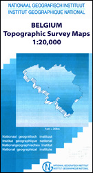
- Sankt Vith - Amel /Ambleve
- Topographical survey of Belgium at 1:20,000 from Nationaal Geografisch Instituut / Institut Géographique National, the country’s national survey organization. Each 20K map covers one quarter of the corresponding 1:50,000 map (with adjustments in the border and coastal areas). The maps provide all the information expected of topographic mapping... Read more
Stanfords
United Kingdom
United Kingdom
- Herzele - Ninove
- Topographical survey of Belgium at 1:20,000 from Nationaal Geografisch Instituut / Institut Géographique National, the country’s national survey organization. Each 20K map covers one quarter of the corresponding 1:50,000 map (with adjustments in the border and coastal areas). The maps provide all the information expected of topographic mapping... Read more

Stanfords
United Kingdom
United Kingdom
- Gemmenich - Botzelaar
- Topographical survey of Belgium at 1:20,000 from Nationaal Geografisch Instituut / Institut Géographique National, the country’s national survey organization. Each 20K map covers one quarter of the corresponding 1:50,000 map (with adjustments in the border and coastal areas). The maps provide all the information expected of topographic mapping... Read more
Stanfords
United Kingdom
United Kingdom
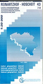
- Reinartzhof - Hoscheit
- Topographical survey of Belgium at 1:20,000 from Nationaal Geografisch Instituut / Institut Géographique National, the country’s national survey organization. Each 20K map covers one quarter of the corresponding 1:50,000 map (with adjustments in the border and coastal areas). The maps provide all the information expected of topographic mapping... Read more
Stanfords
United Kingdom
United Kingdom
- Modave - Clavier
- Topographical survey of Belgium at 1:20,000 from Nationaal Geografisch Instituut / Institut Géographique National, the country’s national survey organization. Each 20K map covers one quarter of the corresponding 1:50,000 map (with adjustments in the border and coastal areas). The maps provide all the information expected of topographic mapping... Read more

Stanfords
United Kingdom
United Kingdom
- Ouren
- Topographical survey of Belgium at 1:20,000 from Nationaal Geografisch Instituut / Institut Géographique National, the country’s national survey organization. Each 20K map covers one quarter of the corresponding 1:50,000 map (with adjustments in the border and coastal areas). The maps provide all the information expected of topographic mapping... Read more


Stanfords
United Kingdom
United Kingdom
- Czech Republic Road Atlas
- Czech Republic Road Atlas from Shocart in an A4, paperback format with enlargements showing access to 13 main cities, illustrated notes on the country’s UNESCO heritage sites, plus an extensive index.Road and rail networks are shown on a base map with relief shading to present the topography. National parks and other protected areas are marked.... Read more

Stanfords
United Kingdom
United Kingdom
- World War I Macedonian Front: Couronne
- Couronne, one of two maps covering the site of the Battle of Doiran between British and Greek troops against Bulgarian forces on the Macedonian Front during World War I. Both maps are reproductions by G.H. Smith & Son of the original British Army trench maps at approximately 7/10th of the original scale quoted against each title.This title, the... Read more

Stanfords
United Kingdom
United Kingdom
- Limerle - Lengeler
- Topographical survey of Belgium at 1:20,000 from Nationaal Geografisch Instituut / Institut Géographique National, the country’s national survey organization. Each 20K map covers one quarter of the corresponding 1:50,000 map (with adjustments in the border and coastal areas). The maps provide all the information expected of topographic mapping... Read more
Stanfords
United Kingdom
United Kingdom
- Flobecq - Brakel
- Topographical survey of Belgium at 1:20,000 from Nationaal Geografisch Instituut / Institut Géographique National, the country’s national survey organization. Each 20K map covers one quarter of the corresponding 1:50,000 map (with adjustments in the border and coastal areas). The maps provide all the information expected of topographic mapping... Read more

Stanfords
United Kingdom
United Kingdom
- Cuba GiziMap Road Map
- Cuba with excellent topographic information on an indexed map from Gizi, with a street plan of central Havana, enlargements for the Varadero Peninsula, Valle de Viñales and the environs of the capital, plus a distance table.Vivid altitude colouring with graphics for mangrove and swamps, plus plenty of names of geographical features: peaks,... Read more