
California
Description
Another great hiking state is California, in the southwest and bordering on the Pacific Ocean.
A number of high mountain ranges can be found in this state – Sierra Nevada, Cascades, Coast Range – canyons, desert, wild coastline.
The main part of the Pacific Crest Trail – 1680 miles out of 2638 miles – lies in this state. Other trails are the John Muir Trail, the Tahoe Rim Trail, and the Tahoe-Yosemite Trail. The Sierra High Route is one of the most demanding alpine trails (195 miles).
Next are the American Discovery Trail (6356 miles), the Bigfoot Trail, the Bay Area Ridge Trail, and some long distance trails still under construction.
The Yosemite National Park is beautiful, but overcrowded, unless you escape to the remoter wilderness areas.
In the Sequoia and Kings Canyon National Parks you can still find virgin forests. With 14,495 feet, Mount Whitney in the Sierra range is the highest mountain outside Alaska. The tall 300 feet high redwoods can be found in the Humboldt Redwoods State Park.
There are many more parks and forests, all with hiking possibilities. Yes, California!
Map

Trails in this state
Links
Facts
Reports
Guides and maps
Lodging
Organisations
Tour operators
GPS
Other
Books

United Kingdom
- Waldviertel North - Gmund - Heidenreichstein - Waidhofen & Raabs a.d.T. - Trebon F&B WK075
- Waldviertel North - Gmünd - Heidenreichstein - Waidhofen a.d.T. - Raabs a.d.T. – Trebon area of eastern Austria presented at 1:50,000 in a series of contoured and GPS compatible outdoor leisure map from Freytag & Berndt with hiking and cycling routes, mountain huts, campsites and youth hostels, local bus stops, plus other tourist information.To... Read more
United Kingdom
- Oregon Uncaged
- A Tale of Two-Sips on the Pacific Crest Trail Read more

United Kingdom
- Discovering the John Muir Trail
- An Inspirational Guide to America's Most Beautiful Hike Read more

United Kingdom
- Afoot & Afield: Los Angeles County
- 259 Spectacular Outings in Southern California Read more

United Kingdom
- Moon Drive & Hike Pacific Crest Trail (First Edition)
- The Best Trail Towns, Day Hikes, and Road Trips In Between Read more

United Kingdom
- Spooky Trails and Tall Tales California
- Hiking the Golden State's Legends, Hauntings, and History Read more

United Kingdom
- Pacific Crest Trail, The
- Hiking America's Wilderness Trail Read more

United Kingdom
- Mojave Desert Peaks
- Hiking the Crown of the California Desert Read more

United Kingdom
- Swimming Holes of California (Pro Tour)
- Black and White version Read more


United Kingdom
2020
- Moon California Hiking (Eleventh Edition)
- The Complete Guide to 1,000 of the Best Hikes in the Golden State Read more
- Also available from:
- De Zwerver, Netherlands

Netherlands
2020
- Wandelgids California Hiking - Californie | Moon Travel Guides
- Pack a lunch, lace up your boots, and head out to discover the best hiking trails in the Golden State with Moon California Hiking.*A Hike for Everyone: Pick the right hike for you, from breathtaking coastal walks to challenging backcountry treks, with options ranging from easy day hikes to multi-day backpacking trips*Best Hikes Lists: Choose... Read more

United Kingdom
- 52 Weekend Adventures in Northern California (First Edition)
- My Favorite Outdoor Getaways Read more
United Kingdom

Maps

United Kingdom
- Whiskeytown - Shasta - Trinity National Recreational Area CA
- Whiskeytown - Shasta - Trinity National Recreational Area in northern California on a series of detailed, contoured maps from Earthwalk Press with cartography based on the USGS topographic survey of the country plus additional information for visitors, printed on light, waterproof and tear-resistant synthetic paper. The map provides the best... Read more

United Kingdom
- San Francisco Bay Area Road & Recreation Map
- Main map 1:200,000 detailed coverage from the Golden Gate south to Santa Cruz & Monterey BayOverside map of San Francisco County (approx. 1:30,000)City Enlargements of various scales include: Central Berkeley/ University of California (1:12,000), Central Oakland / Lake Merritt (1:12,000), Central San Jose (1:12,000), Central Santa Cruz (approx.... Read more

United Kingdom
- Lassen Volcanic National Park CA
- Map No. 268, Lassen Volcanic National Park in California at 1:50,000, part of an extensive series of GPS compatible, contoured hiking maps of USA’s national and state parks or forests and other popular recreational areas. Cartography, based on the national topographic survey, has extensive additional tourist information.The maps, printed on... Read more

United Kingdom
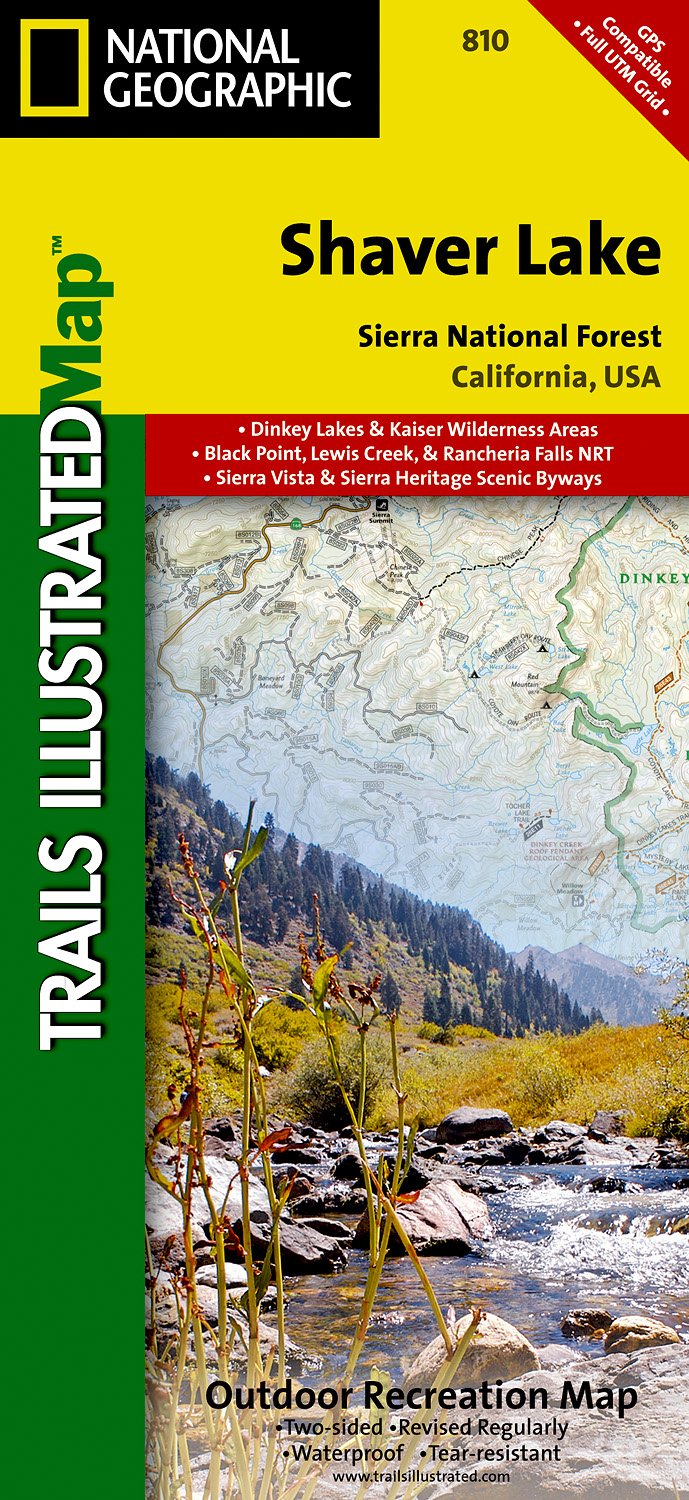
- Shaver Lake - Sierra National Forest CA
- Map No. 810, Shaver Lake / Sierra National Forest, CA, in an extensive series of GPS compatible, contoured hiking maps of USA’s national and state parks or forests and other popular recreational areas. Cartography based on the national topographic survey, with additional tourist information.The maps, with most titles now printed on light,... Read more
- Also available from:
- The Book Depository, United Kingdom
- De Zwerver, Netherlands

United Kingdom
- Shaver Lake/sierra National Forest
- Trails Illustrated Other Rec. Areas Read more
Netherlands
- Wandelkaart - Topografische kaart 810 Shaver Lake - Sierra National Forest | National Geographic
- Prachtige geplastificeerde kaart van het bekende nationaal park. Met alle recreatieve voorzieningen als campsites, maar ook met topografische details en wandelroutes ed. Door uitgekiend kleurgebruik zeer prettig in gebruik. Scheur en watervast! Trails Illustrated Shaver Lake / Sierra National Forest is the second of five exciting new maps for... Read more

United Kingdom
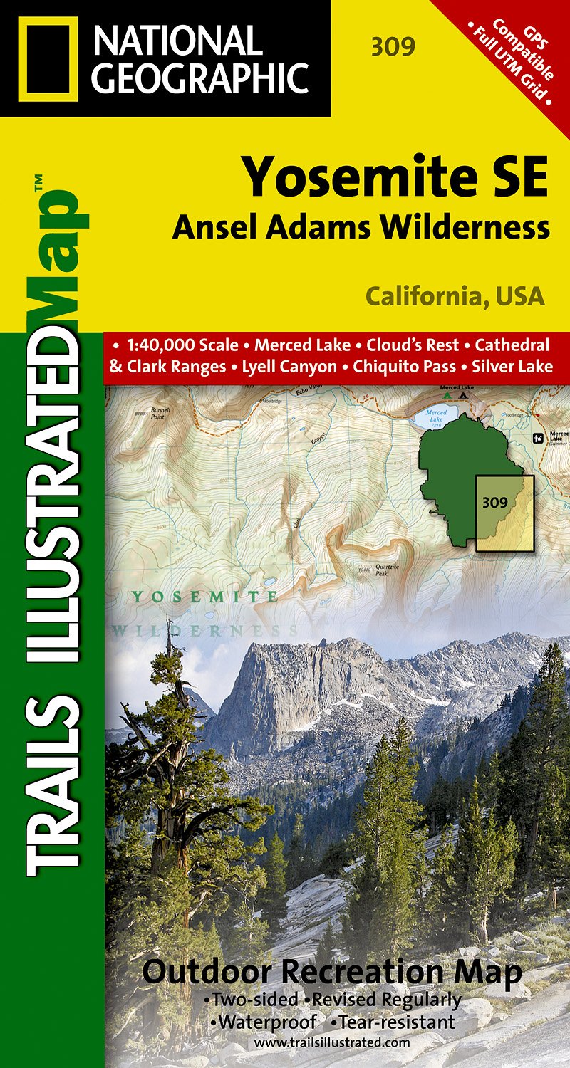
- Yosemite SE - Ansel Adams Wilderness CA
- Map No. 309, Yosemite SE: Ansel Adams Wilderness, CA, in an extensive series of GPS compatible, contoured hiking maps of USA’s national and state parks or forests and other popular recreational areas. Cartography based on the national topographic survey, with additional tourist information.The maps, with most titles now printed on light,... Read more
- Also available from:
- The Book Depository, United Kingdom
- De Zwerver, Netherlands

United Kingdom
- Yosemite Se, Ansel Adams Wilderness
- Trails Illustrated National Parks Read more
Netherlands
- Wandelkaart 309 Yosemite SE - Ansel Adams Wilderness | National Geographic
- Prachtige geplastificeerde kaart van het nationaal park. Met alle recreatieve voorzieningen als campsites, maar ook met topografische details en wandelroutes ed. Door uitgekiend kleurgebruik zeer prettig in gebruik. Scheur en watervast! Coverage of the Tuolomne Meadows and Hoover Wilderness area of Yosemite National Park includes Ansel Adams... Read more

United Kingdom
- Alpine Lakes Wilderness - Mt Baker-Snoqualmie and Okanogan-Wenatchee National Forests WA
- Map No. 825, Alpine Lakes Wilderness Area - Mount Baker-Snoqualmie Wilderness Areas and Okanogan-Wenatchee National Forests, WA, in an extensive series of GPS compatible, contoured hiking maps of USA’s national and state parks or forests and other popular recreational areas. Cartography based on the national topographic survey, with additional... Read more
- Also available from:
- Bol.com, Netherlands
- Bol.com, Belgium

Netherlands
- Alpine Lakes Wilderness Area, Mount Baker-snoqualmie & Okanogan-wenatchee National Forests
- Waterproof Tear-Resistant Topographic MapMount Baker-Snoqualmie and Okanogan-Wenatchee National Forests Washington, USAOne of five new Trails Illustrated maps for the Washington Cascades region offering the most detailed and up-to-date map for the forest, carefully researched and developed in co-operation with local land managers and... Read more
Belgium
- Alpine Lakes Wilderness Area, Mount Baker-snoqualmie & Okanogan-wenatchee National Forests
- Waterproof Tear-Resistant Topographic MapMount Baker-Snoqualmie and Okanogan-Wenatchee National Forests Washington, USAOne of five new Trails Illustrated maps for the Washington Cascades region offering the most detailed and up-to-date map for the forest, carefully researched and developed in co-operation with local land managers and... Read more
Netherlands
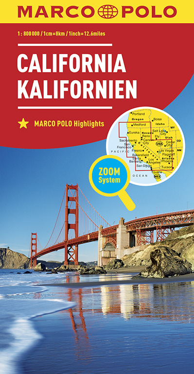
- Wegenkaart - landkaart California - Californië | Marco Polo
- MARCO POLO Länderkarte Kalifornien 1:800 000 ab 11.99 EURO Mit Marco Polo Highlights und Zoom System Marco Polo Karte. 10. Auflage Read more

Netherlands
2024

United Kingdom
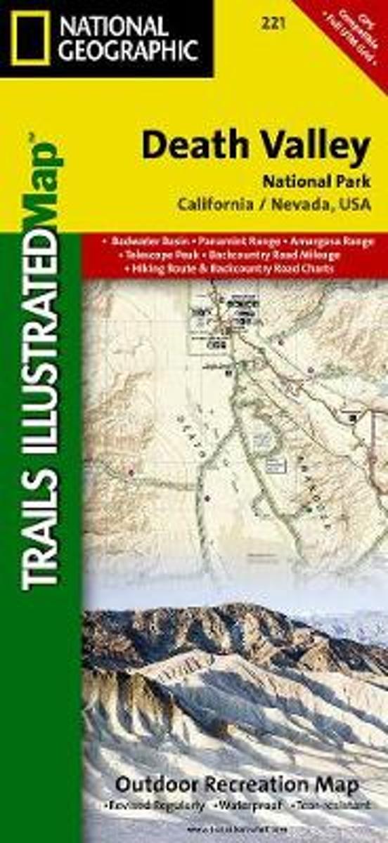
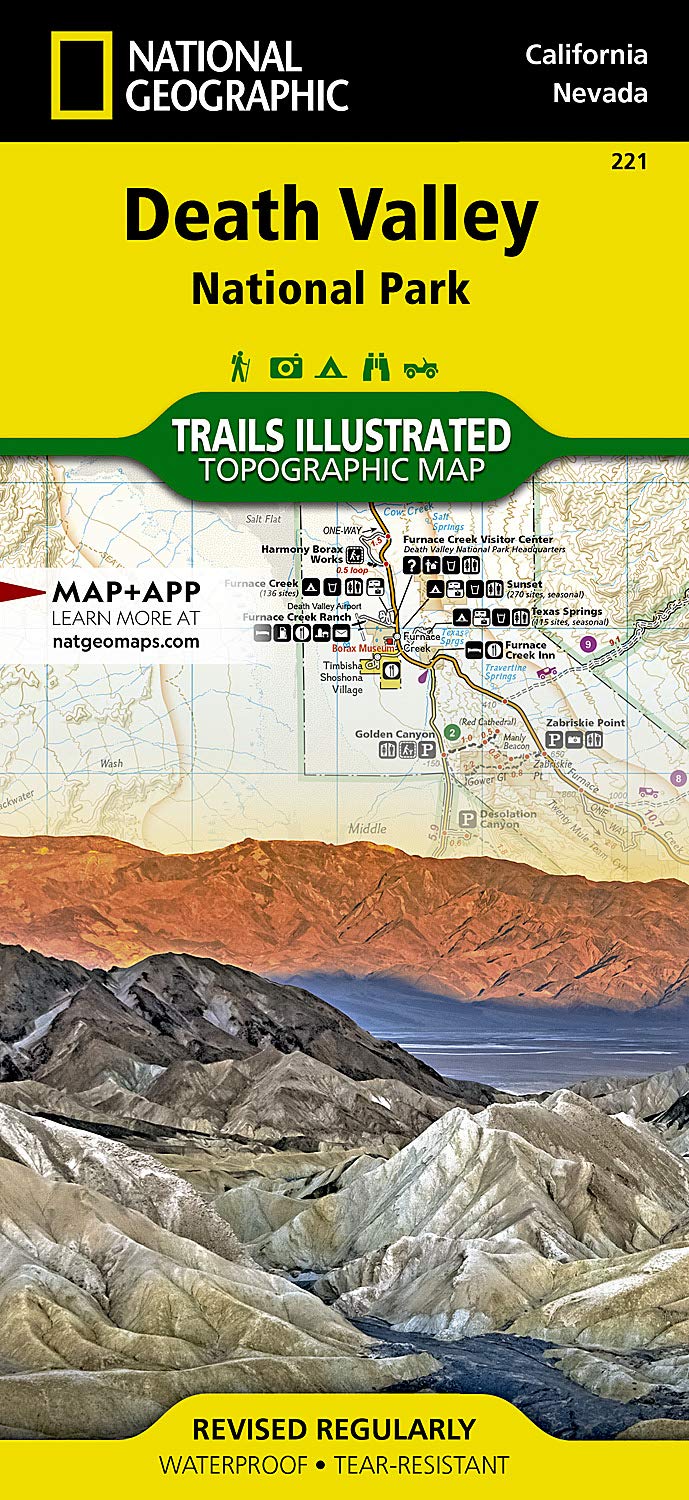
- Death Valley National Park CA/NV NGS Trails Illustrated Map 221
- Map No. 221, Death Valley National Park, CA/NV, in an extensive series of GPS compatible, contoured hiking maps of USA’s national and state parks or forests and other popular recreational areas. Cartography based on the national topographic survey, with additional tourist information.The maps, with most titles now printed on light, waterproof... Read more
- Also available from:
- The Book Depository, United Kingdom
- Bol.com, Netherlands
- Bol.com, Belgium
- De Zwerver, Netherlands

United Kingdom
- Death Valley National Park
- Trails Illustrated National Parks Read more
Netherlands
- Death Valley National Park
- Waterproof Tear-Resistant Topographic MapDespite its foreboding name and the fact that it is the hottest, lowest, and driest area in North America, Death Valley National Park maintains a great diversity of life in its dramatic terrain of salt-flats, canyons, mountains, valleys, sand dunes, and badlands. National Geographic's Trails... Read more
Belgium
- Death Valley National Park
- Waterproof Tear-Resistant Topographic MapDespite its foreboding name and the fact that it is the hottest, lowest, and driest area in North America, Death Valley National Park maintains a great diversity of life in its dramatic terrain of salt-flats, canyons, mountains, valleys, sand dunes, and badlands. National Geographic's Trails... Read more
Netherlands
- Wandelkaart - Topografische kaart 221 Trails Illustrated Death Valley National Park | National Geographic
- Prachtige geplastificeerde kaart van het bekende nationaal park. Met alle recreatieve voorzieningen als campsites, maar ook met topografische details en wandelroutes ed. Door uitgekiend kleurgebruik zeer prettig in gebruik. Scheur en watervast! This Trails Illustrated topographic map for Death Valley National Park, which straddles the state... Read more

United Kingdom
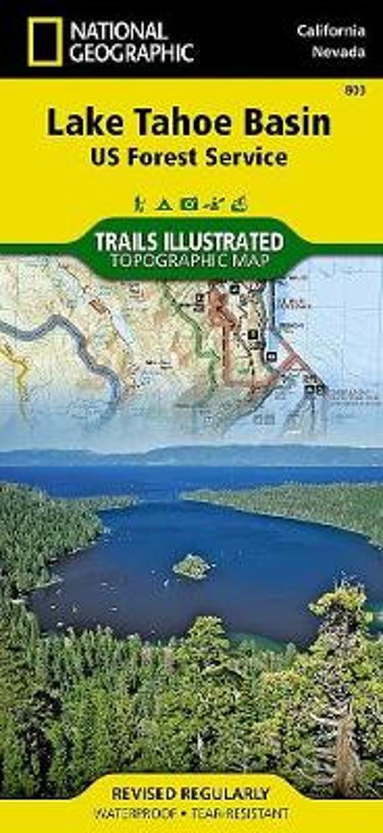
- Lake Tahoe Basin CA NGS Trails Illustrated Map 803
- Map No. 803, Lake Tahoe Basin, CA, in an extensive series of GPS compatible, contoured hiking maps of USA’s national and state parks or forests and other popular recreational areas. Cartography based on the national topographic survey, with additional tourist information.The maps, with most titles now printed on light, waterproof and... Read more
- Also available from:
- The Book Depository, United Kingdom
- Bol.com, Netherlands
- Bol.com, Belgium
- De Zwerver, Netherlands

Netherlands
- Lake Tahoe Basin
- Waterproof Tear-Resistant Topographic MapThe largest alpine lake in North America, Lake Tahoe straddles the border of California and Nevada. It's unusually clear waters and surrounding Sierra Nevada mountains make it one of the most beautiful lakes in the world. National Geographic's Trails Illustrated map of Lake Tahoe Basin delivers... Read more
Belgium
- Lake Tahoe Basin
- Waterproof Tear-Resistant Topographic MapThe largest alpine lake in North America, Lake Tahoe straddles the border of California and Nevada. It's unusually clear waters and surrounding Sierra Nevada mountains make it one of the most beautiful lakes in the world. National Geographic's Trails Illustrated map of Lake Tahoe Basin delivers... Read more

Netherlands
- Wandelkaart - Topografische kaart 803 Lake Tahoe Basin | National Geographic
- Prachtige geplastificeerde kaart van het bekende nationaal park. Met alle recreatieve voorzieningen als campsites, maar ook met topografische details en wandelroutes ed. Door uitgekiend kleurgebruik zeer prettig in gebruik. Scheur en watervast! This Trails Illustrated folded map offers comprehensive coverage of the Lake Tahoe Basin. Lists... Read more

United Kingdom
- Mammoth Lakes - Mono Divide CA
- Map No. 809, Mammoth Lakes / Mono Divide, CA, in an extensive series of GPS compatible, contoured hiking maps of USA’s national and state parks or forests and other popular recreational areas. Cartography based on the national topographic survey, with additional tourist information.The maps, with most titles now printed on light, waterproof and... Read more
- Also available from:
- Bol.com, Netherlands
- Bol.com, Belgium
- De Zwerver, Netherlands

Netherlands
- Mammoth Lakes/mono Divide
- Waterproof Tear-Resistant Topographic MapTrails Illustrated Mammoth Lakes / Mono Divide is the first of five exciting new maps for the California Sierra Nevadas that will combine to form seamless coverage of the high-use National Forest areas between Sequoia / Kings Canyon National Parks and Lake Tahoe. This region contains some of the... Read more
Belgium
- Mammoth Lakes/mono Divide
- Waterproof Tear-Resistant Topographic MapTrails Illustrated Mammoth Lakes / Mono Divide is the first of five exciting new maps for the California Sierra Nevadas that will combine to form seamless coverage of the high-use National Forest areas between Sequoia / Kings Canyon National Parks and Lake Tahoe. This region contains some of the... Read more

Netherlands
- Wandelkaart - Topografische kaart 809 Mammoth Lakes - Mono Divide - Inyo and Sierra National Forests | National Geographic
- Prachtige geplastificeerde kaart van het bekende nationaal park. Met alle recreatieve voorzieningen als campsites, maar ook met topografische details en wandelroutes ed. Door uitgekiend kleurgebruik zeer prettig in gebruik. Scheur en watervast! Trails Illustrated Mammoth Lakes / Mono Divide is the first of five exciting new maps for the... Read more

United Kingdom
- Carson-Iceberg - Emigrant and Mokleumne Wilderness Areas CA
- Map No. 807, Carson-Iceberg / Emigrant / Mokleumne Wilderness Areas, CA, in an extensive series of GPS compatible, contoured hiking maps of USA’s national and state parks or forests and other popular recreational areas. Cartography based on the national topographic survey, with additional tourist information.The maps, with most titles now... Read more
- Also available from:
- Bol.com, Netherlands
- Bol.com, Belgium

Netherlands
- Carson-iceberg/emigrant/mokleumne Wilderness Areas
- Waterproof Tear-Resistant Topographic MapPart of our exciting new coverage for California's Sierra Nevada, our Carson-Iceberg, Emigrant and Mokelumne Wilderness Trails Illustrated map details the high use recreation areas of Stanislaus and Humboldt-Toiyabe National Forests from Yosemite National Park north to Caples Lake and Markleeville.... Read more
Belgium
- Carson-iceberg/emigrant/mokleumne Wilderness Areas
- Waterproof Tear-Resistant Topographic MapPart of our exciting new coverage for California's Sierra Nevada, our Carson-Iceberg, Emigrant and Mokelumne Wilderness Trails Illustrated map details the high use recreation areas of Stanislaus and Humboldt-Toiyabe National Forests from Yosemite National Park north to Caples Lake and Markleeville.... Read more
Netherlands
2017
Netherlands
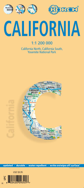
- Wegenkaart - landkaart Californië - California | Borch
- California ( Kalifornien) 1 : 1 200 000 ab 9.9 EURO California North, California South, Yosemite National Park Borch Map. 12. Auflage Read more