
West Virginia
Description
West Virginia is a forested state, good for hiking. The Allegheny Trail largely lies in West Virginia (270 out of 330 miles). The Tuscarora Trail has some 66 miles in this state.
The state also has a share of the American Discovery Trail, the Eastern Continental Trail and the Great Eastern Trail.
By far the largest wilderness in West Virginia is the Monongahela National Forest. Second best would be the George Washington National Forest, in the east, bordering on Virginia.
Map

Trails in this state
Links
Facts
Reports
Guides and maps
Lodging
Organisations
Tour operators
GPS
Other
Books
Stanfords
United Kingdom
United Kingdom
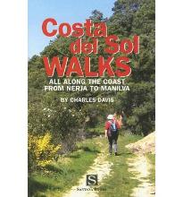
- Costa Del Sol Walks
- Full-color guide to thirty-four walks all within a short distance from the coast, from Nerja to Manilva. With easy-to-follow route notes, full-color maps and clear instructions on how to get to the start of each walk. Read more

Stanfords
United Kingdom
United Kingdom
- DK Eyewitness California
- Dreamin` of California?Whether you want to hike to the waterfalls in Yosemite National Park, tour a winery in Napa or ride a classic cable car in San Francisco, your DK Eyewitness travel guide makes sure you experience all that California has to offer.California`s dramatic landscape has inspired generations of artists and explorers - from... Read more

Stanfords
United Kingdom
United Kingdom
- Rick Steves Pocket Paris (Fourth Edition)
- Make the most of every day and every dollar with Rick Steves! This colorful, compact guidebook is perfect for spending a week or less in Paris: City walks and tours: Six detailed tours and walks showcase Paris`s essential sights, including the Louvre, the Orsay Museum, Notre-Dame, a stroll along the Left Bank, and moreRick`s strategic advice on... Read more

Stanfords
United Kingdom
United Kingdom
- Rick Steves Pocket Vienna - Third Edition
- Make the most of every day and every dollar with Rick Steves! This colourful, compact guidebook is perfect for spending a week or less in Vienna: - City walks and tours: Seven detailed self-guided walks including a central Vienna walk, tours of St. Stephen`s Cathedral and Schoenbrunn Palace and more. Rick`s strategic advice on what`s worth your... Read more

Stanfords
United Kingdom
United Kingdom
- DK Eyewitness Switzerland
- Discover Switzerland - a country small in size, but big on experience.Whether you want to hit the slopes, join the Swiss in their national pastime of hut-to-hut hiking, or take a scenic railway journey to remember, your DK Eyewitness travel guide makes sure you experience all that Switzerland has to offer.Full of magical sights and exhilarating... Read more

Stanfords
United Kingdom
United Kingdom
- DK Eyewitness Dordogne, Bordeaux and the Southwest Coast
- Your journey starts here. Featuring DK`s much-loved maps and illustrations, walks and information, plus all new, full-colour photography, this 100% updated guide to Dordogne, Bordeaux and the Southwest Coast brings you the best of this tranquil and picturesque region in a brand-new, lightweight format.What`s inside?- full-colour photography,... Read more

Stanfords
United Kingdom
United Kingdom
- DK Eyewitness Barcelona and Catalonia
- Discover unique architecture, diverse landscapes and a centuries-old culture.Whether you want to enjoy Costa Brava`s laidback lifestyle, marvel at the iconic Sagrada Familia or hike the undulating landscape of long-extinct volcanoes, your DK Eyewitness travel guide makes sure you experience all that Barecelona and Catalonia have to offer.From... Read more

Stanfords
United Kingdom
2019
United Kingdom
2019
- DK Eyewitness Travel Guide Caribbean
- Take in the dizzying views from the top of Jamaica`s Blue Mountains, stroll the cobbled colonial plazas of Habana Vieja, or marvel at the majesty of St. Lucia`s volcanic spires - DK Eyewitness Travel Guide Caribbean covers the must-see sights and idyllic islands, so you won`t miss a thing.- Gorgeous, all-new colour photography so you can... Read more

Stanfords
United Kingdom
2022
United Kingdom
2022
- DK Eyewitness Alaska
- Epic landscapes, abundant wildlife and unforgettable adventures - welcome to Alaska.Whether you want to be awed by its jaw-dropping scenery, spend time in the national parks, or learn about the rich historical roots of native culture, your DK Eyewitness travel guide makes sure you experience all that Alaska has to offer.Alaska is an outdoor... Read more

Stanfords
United Kingdom
United Kingdom
- Rick Steves Pocket Munich & Salzburg (Second Edition)
- Make the most of every day and every dollar with Rick Steves! This colorful, compact guidebook is perfect for spending a week or less in Munich and Salzburg: City walks and tours: Five detailed self-guided walks including a Munich city walk, Nymphenburg Palace tour, Sound of Music tour, and more Rick`s strategic advice on what`s worth your time... Read more

Stanfords
United Kingdom
United Kingdom
- Tenerife 8/2012 – REMOVED FROM WEBSITE BECAUSE OF DISTRIBUTION PROBLEMS
- About this series:Landmark Visitors Guides present the reader with a detailed, wide-ranging, and easy-to-read overview of an area, making them not only useful guides while on a trip, but also an ideal way to get acquainted with an area before you go.Each guide offers a wide array of information on history & culture, local colour & character,... Read more

Stanfords
United Kingdom
2013
United Kingdom
2013
- Lanzarote: Car Tours and Walks
- Lanzarote is the Sunflower Landscapes guide to exploring the best walking and touring possibilities on the island. The guide covers a range of routes including walks in La Graciosa, Maguez, Mancha Blanca, Yaiza and Lobos. A double-sided, fold-out touring map of Lanzarote gives an overview of the island and the locations of each walk. Detailed... Read more

Stanfords
United Kingdom
2021
United Kingdom
2021
- DK Eyewitness France
- Discover France`s special je ne sais quoiWhether you want to visit fairytale chateaux, stroll amid rolling fields of blossoming lavender or learn what makes a noble vintage, your DK Eyewitness travel guide makes sure you experience all that France has to offer.Few countries capture the imagination quite like France. The world-famous cuisine is... Read more

Stanfords
United Kingdom
2020
United Kingdom
2020
- DK Eyewitness Krakow 14/5/20
- Krakow/Cracow a regal city frozen in time.Whether you want to enjoy a coffee in the iconic market square, explore the cavernous Wieliczka salt mine or simply indulge on moreish Pierogi, your DK Eyewitness travel guide makes sure you experience all that Krakow has to offer.Winding medieval streets, monumental palaces, soaring gothic spires and... Read more

Stanfords
United Kingdom
2015
United Kingdom
2015
- Gran Canaria Sunflower Landscape Guide
- Gran Canaria in the Sunflower Landscapes guide series; exploring the best walking and touring possibilities in the region or area. Detailed information about touring by hired car or public transport, as well as on foot, is provided, helping walkers to navigate and plan day-trips. Shorter strolls are also included as an alternative for each main... Read more
Maps

Stanfords
United Kingdom
United Kingdom
- Tinje
- Tinje, sheet no. 2983-10, in the topographic survey of Nepal at 1:50,000 published by the Nepali Government in the late 1990s and early 2000s and produced from remote sensing data by Finnish cartographers as part of that country’s international aid program. The maps cover 15’ x 15’ quadrangles.IMPORTANT – PLEASE NOTE BEFORE ORDERING:... Read more
Stanfords
United Kingdom
United Kingdom
- Lukla - Salleri
- Lukla - Salleri, sheet no. 2786-07, in the topographic survey of Nepal at 1:50,000 published by the Nepali Government in the late 1990s and early 2000s and produced from remote sensing data by Finnish cartographers as part of that country’s international aid program. The maps cover 15’ x 15’ quadrangles.IMPORTANT – PLEASE NOTE BEFORE ORDERING:... Read more
Stanfords
United Kingdom
United Kingdom
- Takagau
- Takagau, sheet no. 2882-08, in the topographic survey of Nepal at 1:50,000 published by the Nepali Government in the late 1990s and early 2000s and produced from remote sensing data by Finnish cartographers as part of that country’s international aid program. The maps cover 15’ x 15’ quadrangles.IMPORTANT – PLEASE NOTE BEFORE ORDERING:... Read more
Stanfords
United Kingdom
United Kingdom
- Yanma
- Yamna, sheet no. 2787-04, in the topographic survey of Nepal at 1:50,000 published by the Nepali Government in the late 1990s and early 2000s and produced from remote sensing data by Finnish cartographers as part of that country’s international aid program. The maps cover 15’ x 15’ quadrangles.IMPORTANT – PLEASE NOTE BEFORE ORDERING:... Read more
Stanfords
United Kingdom
United Kingdom
- Rachuli
- Rachuli, sheet no. 2981-16, in the topographic survey of Nepal at 1:50,000 published by the Nepali Government in the late 1990s and early 2000s and produced from remote sensing data by Finnish cartographers as part of that country’s international aid program. The maps cover 15’ x 15’ quadrangles.IMPORTANT – PLEASE NOTE BEFORE ORDERING:... Read more
Stanfords
United Kingdom
United Kingdom
- Tiptala Bhañjyan
- Tiptala Bhanjyan, sheet no. 2787-03, in the topographic survey of Nepal at 1:50,000 published by the Nepali Government in the late 1990s and early 2000s and produced from remote sensing data by Finnish cartographers as part of that country’s international aid program. The maps cover 15’ x 15’ quadrangles.IMPORTANT – PLEASE NOTE BEFORE ORDERING:... Read more
Stanfords
United Kingdom
United Kingdom
- Philim
- Philim, sheet no. 2884-12, in the topographic survey of Nepal at 1:50,000 published by the Nepali Government in the late 1990s and early 2000s and produced from remote sensing data by Finnish cartographers as part of that country’s international aid program. The maps cover 15’ x 15’ quadrangles.IMPORTANT – PLEASE NOTE BEFORE ORDERING:... Read more
Stanfords
United Kingdom
United Kingdom
- Lamjun Himal
- Lamjun Himal, sheet no. 2884-09, in the topographic survey of Nepal at 1:50,000 published by the Nepali Government in the late 1990s and early 2000s and produced from remote sensing data by Finnish cartographers as part of that country’s international aid program. The maps cover 15’ x 15’ quadrangles.IMPORTANT – PLEASE NOTE BEFORE ORDERING:... Read more
Stanfords
United Kingdom
United Kingdom
- Taplejung
- Taplejung, sheet no. 2787-11, in the topographic survey of Nepal at 1:50,000 published by the Nepali Government in the late 1990s and early 2000s and produced from remote sensing data by Finnish cartographers as part of that country’s international aid program. The maps cover 15’ x 15’ quadrangles.IMPORTANT – PLEASE NOTE BEFORE ORDERING:... Read more

Stanfords
United Kingdom
United Kingdom
- Europe High 5 Edition Camping Atlas
- The first physical atlas with direct access to useful additional information from the InternetThe entirety of Europe on 432 pages in a scale of 1:800,000 clearly presented, including lots more travel information:- Road Companion (roadmaps) in a scale of 1:800,000, inclusive of the High 5 - Edition app technology for calling up additional travel... Read more

Stanfords
United Kingdom
2021
United Kingdom
2021
- Belgium NGI Long-Distance Trails Map
- Belgium: Long-distance Footpaths Map at 1:300,000 from Nationaal Geografisch Instituut/Institut Géographique National, the country’s national survey organization, showing the network of the waymarked long-distance GR routes.The map uses as its base a road map of the country, with an overprint highlighting the network of Belgium’s long-distance... Read more
Stanfords
United Kingdom
United Kingdom
- Mukot
- Mukot, sheet no. 2883-02, in the topographic survey of Nepal at 1:50,000 published by the Nepali Government in the late 1990s and early 2000s and produced from remote sensing data by Finnish cartographers as part of that country’s international aid program. The maps cover 15’ x 15’ quadrangles.IMPORTANT – PLEASE NOTE BEFORE ORDERING:... Read more
Stanfords
United Kingdom
United Kingdom
- Mt. Everest (Sagarmatha) - Hinku Himal
- Mount Everesr (Sagarmatha) - Hinku Himal, sheet no. 2786-04, in the topographic survey of Nepal at 1:50,000 published by the Nepali Government in the late 1990s and early 2000s and produced from remote sensing data by Finnish cartographers as part of that country’s international aid program. The maps cover 15’ x 15’ quadrangles.IMPORTANT –... Read more
Stanfords
United Kingdom
United Kingdom
- Sisne
- Sisne, sheet no. 2883-03, in the topographic survey of Nepal at 1:50,000 published by the Nepali Government in the late 1990s and early 2000s and produced from remote sensing data by Finnish cartographers as part of that country’s international aid program. The maps cover 15’ x 15’ quadrangles.IMPORTANT – PLEASE NOTE BEFORE ORDERING:... Read more
Stanfords
United Kingdom
United Kingdom
- Barhabise
- Barhabise, sheet no. 2785-04, in the topographic survey of Nepal at 1:50,000 published by the Nepali Government in the late 1990s and early 2000s and produced from remote sensing data by Finnish cartographers as part of that country’s international aid program. The maps cover 15’ x 15’ quadrangles.IMPORTANT – PLEASE NOTE BEFORE ORDERING:... Read more