
Pilgrims Ways
Description
 Ever since the year 813, when the tomb of St.James was claimed to be (re-)discovered there, the city of Santiago de Compostela in northwestern Spain has attracted many thousands of Christian pilgrims from all parts of Europe, particularly in the Middle Ages. As a result, there is no single route or trail. Of course, it all depends on where you start your pilgrimage.
Almost every West European country has an association, society or confraternity dedicated to pilgrimage to Santiago de Compostela, often carrying the name of the apostle involved: St.James, known by numerous translations such as Sint Jacob, Sint Jakobus, Saint-Jacques, Sankt Jakob, Sant Iago, etc. These organisations all provide information on the pilgrimage to their members, and also issue an official internationally recognized ‘pilgrim pass'. Having collected the correct stamps en route, pass-holders are entitled to the official ‘Compostela' certificate to prove that the pilgrimage was accomplished as intended.
Four routes in France traditionally start from Paris, Le Puy, Vézelay and Arles. After crossing the Pyrenees they all join into one rather clearly defined route across the northwest of Spain. Symbol of the Santiago de Compostela Pilgrim Way(s) is a scallop shell, also used for waymarking the route (yellow scallop shell against a blue background).
Spain
Classic route
The classic Way of St. James is the Camino Francés. The three main Ways in France - Via Podiensis, Via Lemovicensis, Via Turonensis - come together in the Pyrenees and cross the mountains near Roncesvaux. Hence, the Camino Francés turns straight west over the plains of northern Spain to Santiago de Compostela, a walk of about a month.The fourth main Way from France - Via Tolosana - crosses the Pyrenees at Col du Somport, follows the Camino Aragonés in Spain, and joins the Camino Francés in Puente la Reina.
- Camino Francés, Roncesvalles / Saint-Jean-Pied-de-Port - Puente la Reina - Santiago de Compostela, 800 km, 32 days
- Camino Aragonés, Col du Somport - Puente la Reina, 200 km, 8 days
Northern routes
You can imagine that the Camino Francés gets pretty crowded! Luckily, many alternatives have been developed over the years, some with historical relevance, others also a little bit for the pleasure of hiking:
- Camino Primitivo, Oviedo - Melida, 350 km, 15 days
- Camino de la Costa, Irun / Hendaye - Ribadeo, 676 km, 34 days
- Camino del Norte, Ribadeo - Arzúa, 159 km, 6 days
- Camino de Invierno, Ponferrada - A Laxe (Lalin), 210 km, 7 days
- Camino de Baztan, Bayonne - Pamplona, 110 km, 5 days
- Camino Vasco del Interior, Irun - Santo Domingo de la Calzada, 204 km, 8 days
- Camino a Finisterre - Muxia, Santiago de Compostela - Finisterre - Muxia, 118 km, 5 days
- Camino del Salvador, Oviedo - León, 120 km, 5 days
From England
Pilgrims from England can cross by boat to La Coruña or Ferrol and walk on to Santiago:
- Camino Inglés, Ferrol - Santiago de Compostela, 110 km, 5 days / La Coruña - Santiago de Compostela, 75 km, 3 days
From Portugal
And coming from Portugal, you can follow the Atlantic coast:
- Camino Portugués, Lisboa - Santiago de Compostela, 632 km, 25 days
From Catalunya
If you rather prefer a totally different approach, you can start in eastern Spain, Catalunya. There is even an option by crossing the Pyrenees in the far east, Le Perthus:
- Camí Català per Huesca, Tàrrega - Santa Cilia, 260 km, 10 days
- Camino de Girona, Rodes - Montserrat, 213 km, 9 days
- Camí Català per Lleida, Barcelona - Logroño, 470 km, 20 days
Mediterranean coast
Going down the Mediterranean coast, we meet new posibilities, starting in the province of Valencia for example:
- Camino del Ebro, Sant Jaume d’Enveja - Fuentes de Ebro / Zaragoza, 220 km, 9 days
- Camino de Tarragona, Tarragona - Lleida / Bellpuig d’Urgell, 138 km, 7 days
- Camino de Levante, Valencia / Cartagena, 725 km, 22 days
South
Becoming more popular, are the Ways that start in the south of Spain, long and hot and feasting on the Reconquista
- Via de la Plata, Sevilla - Astorga, 700 km, 30 days
- Camino Sanabrés, Granja de Moreruela - Santiago de Compostela, 387 km, 15 days
- Via Portugués de la Via de la Plata, Zamora - Ourense, 220 km, 9 days
- Ruta por Toledo, Martos - Madrid, 233 km, 9 days / Montoro - Madrid, 144 km, 7 days
- Camino Mozárabe, Granada - Córdoba - Mérida, 410 km, 17 days
- Ruta desde Málaga, Málaga - Baena, 88 km, 4 days
- Ruta desde Almería, Almería - Córdoba, 316 km, 13 days
- Camino de Santiago de Madrid, Madrid - Sahagún, 325 km, 10 days
- Ruta de la Lana, Alicante - Burgos, 380 km, 15 days
- Via Augusta de Cádiz a Sevilla, Cádiz - Sevilla, 190 km, 8 days
- Camino del Sur, Huelva - Zafra, 190 km, 8 days
France
France has been quick in developing the modern pilgrim routes to Santiago de Compostela. Four main Ways have been laid out, based on historical relevance. These Ways pass numerous churches and other religious monuments dedicated to the mediaeval pilgrimage to Santiago, and this alone makes France a splendid pilgrimage destination. Moreover, pilgrims from Europe had to cross the Pyrenees and to have lengthy wanderings through France if they wanted to visit the holy grave of St. Jacob.
Via Turonensis
Let’s start with these four main Ways. The westernmost is the Via Turonensis, leaving from Paris, passing Tours ending in Ostabat in the Pyrenees. In modern France this is the GR655. In Spain, this Way continues as Camino Francés. Below are the main and side itineraries:
- GR655, Saint-Quentin - Paris (- Ostabat), 234 to Paris, 9 days
- GR22 Sentier du Mont Saint-Micheal, Paris - Mont Saint-Michel, 250 km, 10 days
- Via Turonensis, Paris tour Saint-Jacques-de-la-Boucherie - Tours - Ostabat, 593 km, 24 days
- GR12, Amsterdam - Paris, 977 km, 40 day
- Via Gallia Belgica, Hélécine - Nivelles - Saint-Quentin, 223 km, 9 days
- Voie des Plantagenêts, Mont-Saint-Michel - Aulnay, 203 km, 8 days
Via Lemovicencis
Next, parallel to the previous Way, is the Via Lemovicencis, popular for pilgrims from northern Europe. The modern version is the GR654, but be aware that this GR takes a different route from the official pilgrims way. Both routes are, in terms of landscape, more interesting than the first Way over Paris.
- Via Monastica, ‘s-Hertogenbosch - Rocroi, 325 km, 13 days
- Via Arduinna, Aken / Luik / Malmedy - Orval, 220 km, 9 days
- GR654, (Namur - ) Rocroi - Vézelay - Montréal, 1500 km, 60 days, add another 200 km to Ostabat via GR65, or Rocroi - Vézelay - Ostabat, 1650 km, 66 days
- Via Lemovicensis, Vézalay - Ostabat. 900 km, 36 days
- GR300 - Voie du Bourbonnais, Sancoins - Clermont Ferrand, 197 km, 8 days
- Jakobsweg Waldshut-Vézelay, Waldshut (D) - Basel (Ch) - Vézelay (F), 475 km, 20 days
Via Podiensis
The third main route, and like the previous one a pretty route too, is the Way over Le Puy-en-Velay, the Via Podiensis. This has been dubbed the GR65. This important Way was and is used by pilgrims from the south and central Europe, from Hungary to Poland.
- Jakobsweg im Elsass, Speyer (D) - Wissembourg (F) - Couthenans, 370 km, 15 days
- Jakobsweg Breisach (D) - Cluny (F), 450 km, 18 days
- Via Arvernia / Arverna, Clermont-Ferrand - Cahors, 300 km, 12 days
- Via Gebennensis, Geneva - Le Puy-en-Velay, 330 km, 13 days
- GR65, Geneva - Le Puy-en-Velay - Ostabat, 1090 km, 44 days
- Via Podiensis, Le Puy-en-Velay - Ostabat, 740 km, 30 days
- GR700 Chemin de Régordane, Saint-Gilles - Le Puy-en-Velay, 242 km, 10 days
- E3, Santiago de Compostela (Es) - Emine (Bg), 6950 km, 350 days
Via Tolosana
The fourth main Way is the Via Tolosana, bringing pilgrims from Italy, and connecting to the other important pilgrim destination, Rome. Traveling via Toulouse, these pilgrims cross the Pyrenees at the Col du Somport. The state name is GR653.
- Via Tolosana, GR653, Arles - Col du Somport, 800 km, 32 days
- GR101, Maubourguet - Lourdes, 64 km, 3 days
- Via Domitia, GR653D, Voie d’Arles, Col de Montgenevre - Arles, 430 km, 17 days
- Via Aurelia, GR653A, Menton - Arles, 385 km, 16 days
- Voie du Piémont, Narbonne - Lourdes - Saint Jean-Pied-de-Port, 600 km, 24 days
- Voie Catalane - Roussillon, Narbonne - Le Perthus, 120 km, 5 days
New Ways
Modern times and modern devotion asks for new horizons. So, we are not done with mentioning the four main Ways. New ways have been developed over the last years.
- Voie Littorale, Pointe de Grave (Gironde) - Bayonne / Irun, 370 km, 15 days
Belgium
Belgium has a dense network of pilgrim ways. They run north-south, and bring pilgrims from Holland, Flanders and Wallonia to France. The Belgian Ways of Saint James connect to the Via Turonensis over Paris and the Via Lemovicensis over Vézelay. There are five main clusters of trails.
Central-west
One of the main routes is the central-west route connecting the west of the Netherlands to the Via Turonensis, GR655.
- Via Brabantica and Via Brabançonne, Bergen op Zoom (Nl) - Antwerp - Mechelen - Brussels - Nijvel, 161 km, 6 days
- GR12, Amsterdam - Paris, 977 km, 40 day
- Via Gallia Belgica, Hélécine - Nivelles - Saint-Quentin, 223 km, 9 days
Central-east
The second important route runs parallel to the Via Brabantica, connecting ‘s-Hertogenbosch in the Netherlands to Namur in Belgium. This route connects to Vézelay, the Via Lemovicensis.
- Via Monastica, ‘s-Hertogenbosch - Rocroi, 325 km, 13 days
Shortcuts
Between these two main vines of the Way of Saint James in Belgium, several shortcuts are available so that if you change your mind, and turn to Paris instead of Vézelay, or vice versa.
- Via Thiérache, Olloy-sur-Viroin - Saint-Quentin, 120 km, 5 days
- GR126, Brussels - Namur - Membre-sur-Semois, 224 km, 9 days
East
The third route is probably the most popular one for Dutch Pilgrims, not because it is the shortest, but rather because it is a nice one to walk. It connects the Pelgrimspad to the Vézalay route, the GR654.
- Via Mosana, Maastricht - Namur, 125 km, 5 days
- Via Limburgica, Thorn - Eghezée, 130 km, 5 days
West
Then we should mention a coastal route from the Netherlands, entering Belgium at Sluis. This route is bending east and connects to the Via Turonensis.
- Via Brugensis, Sluis (nl) - Brugge (be) - Sebourg (fr), 150 km, 6 days
- Via Scaldea, Sluis (nl) - Gent (be) - Pecq, 67 km 3 days
- GR122, Sebourg - St Fergueux
Ardennes
And finally, a nice route is being developed in the Ardennes.
- Via Arduinna, Aken / Luik / Malmedy - Orval, 220 km, 9 days
Netherlands
The Netherlands is a country of hiking fervents, so it is not surprising that there are quite a number of pilgrim ways crisscrossing the country. One will clearly observe a difference between those trails that are meant to please the senses, and those that are meant to call upon as many churches as possible. The latter are recognisable by their fancy mediaeval names starting with “Jacobsweg”.
Due to the country’s geographical location, there are two obvious directions to Santiago de Compostela: one over Paris (Via Turonensis) and one over Vézelay (Via Lemovicensis). Since the latter is far more popular, most Dutch pilgrims follow Ways to Limburg, the southeastern corner bordering Belgium and Germany.
Coastal Way to Paris
Let’s start with the option over Paris along the coast. Starting in Wieringen or in Den Oever, the pilgrims head for Haarlem.
- Jacobsweg Amstelredam, den Oever - Haarlem (- Roermond, 385 km, 16 days)
- Van Wad tot IJ, Wieringen - Haarlemmerliede, 150 km, 6 days
From Haarlem, the path continues south more or less along the coast. In Schipluiden is a bifurcation: one way goes east to Antwerpen,the other continues south. Continuing south, there is a second split in Vlissingen. One way goes to Brugge in Belgium, the other to Gent in Belgium.
- Jacobsweg Thuredrecht, Schipluiden - Kapellen (B), 154 km, 6 days
- Jacobsweg Die Haghe, Haarlem - Schipluiden - Vlissingen - Brugge, 224 km, 9 days
- Jacobsweg Die Haghe, alternative Vlissingen - Gent, 63 km, 3 days
In Belgium, continue the pilgrimage on the Via Brugensis (over Brugge), Via Scaldea (over Gent), or Via Brabantica (over Antwerpen).
- Via Brugensis, Sluis (nl) - Brugge (be) - Sebourg (fr), 150 km, 6 days
- Via Scaldea, Sluis (nl) - Gent (be) - Pecq, 67 km 3 days
- Via Brabantica and Via Brabançonne, Bergen op Zoom (Nl) - Antwerp - Mechelen - Brussels - Nijvel, 161 km, 6 days
Main Way to Paris
The other pilgrim way to Paris has historic roots. The start is in the north of the country, either in the village Sint-Jacobiparochie or in the town Uithuizen. These Ways head for the village Hasselt. Then the route continues to Utrecht, Breda and Antwerpen in Belgium.
- Jacobsweg Amsvorde, Uithuizen - Antwerpen, 491 km, 20 days
- Jabikspaad, St. Jacobiparochie - Hasselt, 150 km, 6 days
- Jacobspad, Uithuizen - Hasselt, 209 km, 9 days
In Belgium, continue on the Via Brabantica.
- Via Brabantica and Via Brabançonne, Bergen op Zoom (Nl) - Antwerp - Mechelen - Brussels - Nijvel, 161 km, 6 days
There is an alternative: the GR12 connects Amsterdam to Paris. The Dutch part of the GR12 is called the Floris V-Pad.
- Floris V-pad, LAW1-3, Amsterdam - Bergen op Zoom, 245 km, 10 days
- GR12, Amsterdam - Paris, 977 km, 40 days
Main Way to Vézelay
Two Ways connect the busy west of the country to the province of Limburg and Vézelay. The Pelgrimspad is primarily a trail for walkers enjoying the countryside. The Jacobsweg Amstelredam is primarily a trail for pilgrims enjoying cities and cathedrals.
- Pelgrimspad, Amsterdam - Visé (B), 466 km, 20 days
- Jacobsweg Amstelredam, den Oever - Haarlem - Roermond, 385 km, 16 days
- Jacobspad Limburg, Millingen aan de Rijn - Roermond - Maastricht, 220 km, 9 days
From Maastricht, continue your pilgrimage on the Via Mosana to Namur. A second option is to leave the Netherlands in the little town of Thorn and follow the Via Limburgica.
- Via Mosana, Maastricht - Namur, 125 km, 5 days
- Via Limburgica, Thorn - Eghezée, 130 km, 5 days
Eastern Way to Vézelay
Things get a bit complicated here. The same paths in the north of the Netherlands that are used to go to Paris, are also frequented by pilgrims heading for Vézelay. Hasselt has the key to this mystery: the village is a main intersection of pilgrim ways.
From Hasselt, continue on the Jacobsweg Nieumeghen. Halfway, in the old city Doesburg, pilgrims from Oldenzaal will join you. This part of the Way is more or less the same as the Hanzestedenpad.
In Nijmegen one can continue south. But the real pilgrim will make a large detour to ‘s-Hertogenbosch, an important religious center of the Netherlands. The direct Way to Vézelay heads for Maastricht and Liège, Belgium. This route is sometimes on German territory, sometimes on Dutch territory, and even sometimes on Belgian territory.
- Jacobspad, Uithuizen - Hasselt, 209 km, 9 days
- Jabikspaad, St. Jacobiparochie - Hasselt, 150 km, 6 days
- Hanzestedenpad, Kampen - Doesburg, 164 km, 7 days
- Jacobsweg Nieumeghen, Sint jacobiparochie - Hasselt - Roermond - Maastricht - Eijsden (- Visé - Liège), 513 km, 21 days
- Jacobsweg Audenzeel, Oldenzaal - Doesburg, 95 km, 4 days
- Jacobspad Limburg, Millingen aan de Rijn - Roermond - Maastricht (- Eijsden - Liège), 220 km, 9 days
From Maastricht, continue on the Via Mosana. Or - alternatively - follow the Via Limburgica starting from Thorn.
- Via Mosana, Maastricht - Namur, 125 km, 5 days
- Via Limburgica, Thorn - Eghezée, 130 km, 5 days
Switzerland
In Switzerland, the route follows ...
Map


Trails
- Camí Català per HuescaGPX
- Camí Català per LleidaGPX
- Caminho Jacobeu
- Camino a Finisterre - MuxíaGPX
- Camino AragonésGPX
- Camino de BaztanGPX
- Camino de GironaGPX
- Camino de la CostaGPX
- Camino de LevanteGPX
- Camino de Santiago de MadridGPX
- Camino de Santiago de TenerifeGPX
- Camino de Tarragona
- Camino del EbroGPX
- Camino del InviernoGPX
- Camino del NorteGPX
- Camino del SalvadorGPX
- Camino del Sur
- Camino FrancésGPX
- Camino InglésGPX
- Camino MozárabeGPX
- Camino PortuguésGPX
- Camino PrimitivoGPX
- Camino SanabrésGPX
- Camino Vasco del InteriorGPX
- E3GPX
- Floris V-padGPX
- GR100 Ruta de la PlataGPX
- GR101GPX
- GR12 - Amsterdam - ParisGPX
- GR122 - ScheldelandGPX
- GR126 - Brussel-Namen-Membre sur SamoisGPX
- GR22 - Sentier du Mont Saint-MichelGPX
- GR300 - Voie du BourbonnaisGPX
- GR6 Barcelona - MontserratGPX
- GR65 - Via PodiensisGPX
- GR65 Camino de SantiagoGPX
- GR653 - Via TolosanaGPX
- GR653A - Via AureliaGPX
- GR653D - Voie d’ArlesGPX
- GR654 - Via LemovicensisGPX
- GR655 - Via TuronensisGPX
- GR700 - Chemin de RégordaneGPX
- GR78 - Sentier de PiémontGPX
- HanzestedenpadGPX
- JabikspaadGPX
- JacobspadGPX
- Jacobspad LimburgGPX
- Jacobsweg Amstelredam
- Jacobsweg Amsvorde
- Jacobsweg Audenzeel
- Jacobsweg Die Haghe
- Jacobsweg Nieumeghen
- Jacobsweg Thuredrecht
- JakobswegGPX
- Jakobsweg Breisach - Cluny
- Jakobsweg im Elsass
- Jakobsweg Waldshut-Vézelay
- LutherwegGPX
- PelgrimspadGPX
- Pilgrimsled st OlofGPX
- PilgrimsledenGPX
- Ruta de la LanaGPX
- Ruta desde Almería
- Ruta desde Málaga
- Ruta por Toledo
- Santiago de Compostela Pilgrims WayGPX
- Van Wad tot IJ
- Vía de la PlataGPX
- Via ArduinnaGPX
- Via ArverniaGPX
- Via Augusta de Cádiz a Sevilla
- Via BrabanticaGPX
- Via BrugensisGPX
- Via Gallia BelgicaGPX
- Via GebennensisGPX
- Via JacobiGPX
- Via LimburgicaGPX
- Via MonasticaGPX
- Via MosanaGPX
- Via Portugués de la Via de la Plata
- Via Scaldea
- Via Thiérache
- Voie Catalane - Roussillon
- Voie de Lourdes
- Voie des PlantagenêtsGPX
- Voie du PiémontGPX
- Voie LittoraleGPX
Links
Facts
Reports
Guides and maps
Lodging
Organisations
Tour operators
GPS
Other
Books

United Kingdom
- Chemins de St.Jacques: Cluny/Lyon - Le Puy à pied
- Chemins de St.Jacques: Cluny/Lyon-Le Puy à pied from Chamina presents the route overprinted on IGN’s 1:50,000 topographic survey with details of accommodation, local services and other tourist information.Each stage is shown on extracts from IGN`s 1:50,000 topographic survey cross-referenced to the descriptions of the route. Symbols indicate... Read more

United Kingdom
2012
- GR62B/GR36/GR46 Le Chemin de Conques à Toulouse FFRP Topo-guide No. 3646
- Le Chemin de Conques à Toulouse, FFRP topoguide Ref. no. 3646, covering 563kms of various GR routes in the region of Quercy and the Gorges of the Aveyron between Conques and Cahors in the north and Toulouse and Albi in the south: le Chemin de Conques à Toulouse along the GR62B, 36 and 46; GR 36 from Cahors to Albi; GR46 along the Gorges of the... Read more

United Kingdom
- Les Chemins de St-Jacques au Pays Basque
- Les Chemins de St-Jacques au Pays Basque covers two routes of the Way of St James in the Basque country: le Chemin de Baztán and le Chemin de Saint-Palais á la côte. The former links Bayonne, Saint-Jean de Luz and Urdax, extending south to Pamplona; the latter links Sare to Saint Palais via Esplette. This is one of the titles in a series of... Read more

United Kingdom
- Le Chemin du Vézelay: de la Bourgogne aux Pyrénéees
- Le Chemin du Vézelay: de la Bourgogne aux Pyrénéees covers the one of most popular routes of the Way of St. James in France, from the cathedral in Vézelay, across the La Charité-sur-Loire, Bourges, La Souterraine, Limoges, Périgueux, Ste-Foy-la-Grande, Bazas, Mont-de-Marsan and Orthez to Saint-Jean-Pied-de-Port.This title is part of a series of... Read more
Netherlands
2008
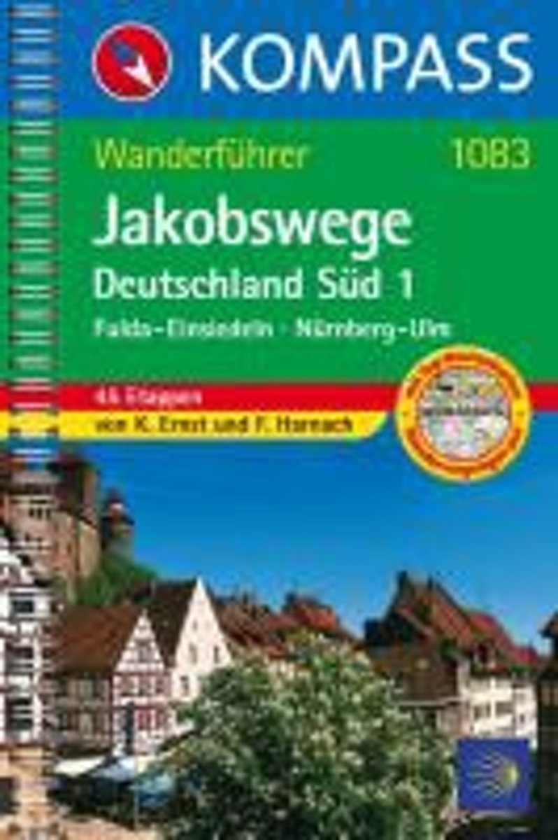
- WF1083 Jakobsweg Deutschland 1, Fulda, Einsiedeln Kompass
- Fulda-Einsiedeln, Nürnberg-Ulm; 45 EtappenDe Kompass wandelgids + kaart geeft een overzicht van alle wandelroutes in het gebied met nauwkeurige routeaanwijzingen en hoogteaanduidingen, De extra grote kaart, schaal 1:35 000, is ideaal om van te voren uw route uit te stippelen en om onderweg te gebruiken • naast de bekende bestemmingen, worden... Read more
- Also available from:
- Bol.com, Belgium
Belgium
2008
- WF1083 Jakobsweg Deutschland 1, Fulda, Einsiedeln Kompass
- Fulda-Einsiedeln, Nürnberg-Ulm; 45 EtappenDe Kompass wandelgids + kaart geeft een overzicht van alle wandelroutes in het gebied met nauwkeurige routeaanwijzingen en hoogteaanduidingen, De extra grote kaart, schaal 1:35 000, is ideaal om van te voren uw route uit te stippelen en om onderweg te gebruiken • naast de bekende bestemmingen, worden... Read more

Netherlands
2012
- Camino Inglés: Der Englische Weg Von Ferrol bis Santiago de Compostela
- Camino Light: Der Jakobsweg in einer Woche. 1., 1. Auflage Read more
- Also available from:
- Bol.com, Belgium
Belgium
2012
- Camino Inglés: Der Englische Weg Von Ferrol bis Santiago de Compostela
- Camino Light: Der Jakobsweg in einer Woche. 1., 1. Auflage Read more
Netherlands
2015
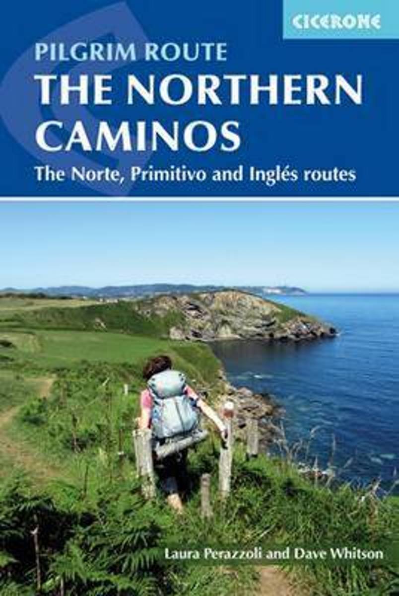
- The northern caminos
- This guidebook is a comprehensive, pocket-sized guide to walking the pilgrimage routes through northern Spain to the sacred city of Santiago de Compostela. The Camino del Norte is an 817km five-week coastal route from the town of Irún, close to the French border. Its alternatives are the Camino Primitivo (which splits from the Norte near Oviedo... Read more
- Also available from:
- Bol.com, Belgium
Belgium
2015
- The northern caminos
- This guidebook is a comprehensive, pocket-sized guide to walking the pilgrimage routes through northern Spain to the sacred city of Santiago de Compostela. The Camino del Norte is an 817km five-week coastal route from the town of Irún, close to the French border. Its alternatives are the Camino Primitivo (which splits from the Norte near Oviedo... Read more
Netherlands
- Jakobsweg - Camino de Santiago
- Der weltberühmte Pilgerweg. Information und Inspiration für die äußere und innere Reise Read more
- Also available from:
- Bol.com, Belgium
Belgium
- Jakobsweg - Camino de Santiago
- Der weltberühmte Pilgerweg. Information und Inspiration für die äußere und innere Reise Read more
Netherlands
2017
- Wandelgids Pelgrimsweg van Vezelay naar St.Jean-pied-de-Port via Bourges | Nederlands Genootschap van Sint Jacob
- Opvallende goede gids van dit deel van de St. Jacobsroute: men heeft goed kaartmateriaal gebruikt waar de route keurig op staat ingetekend. Ook een uitgebreide beschrijving ontbreekt niet .... alleen jammer dat het niet met een ringband is uitgevoerd. Deze gids beschrijft de route vanaf Vézelay tot St.Jean-Pied-de-Port en is gebaseerd op de... Read more

United Kingdom
2013
- GR145: The Via Francigena in Pas-de-Calais FFRP Topo-guide No. 1451
- The first stage in France of the Via Francigena, one of the great medieval pilgrim routes, in a bilingual English / French topoguide with colour extracts from IGN’s topographic survey at 1:50,000, accommodation recommendations, etc.The guide covers a 12 day - 235km long section from Calais to Rocquigny, including parts of WWI Western Front in... Read more
- Also available from:
- De Zwerver, Netherlands

Netherlands
2013
- Wandelgids 1451 La Via Francigena à travers le Pas-de-Calais GR145 | FFRP
- Guide FFRandonnée La Via Francigena à travers le Pas-de-Calais - GR 145 - 245 Km de sentiers GR.Ancienne voie de pèlerinage, au même titre que les chemins de Saint-Jacques ou du Mont-Saint-Michel, ce topo-guide bilingue français/anglais (une grande première !) comprend les 245 premiers kilomètres français de l'itinéraire ancestral reliant... Read more
Netherlands
2017
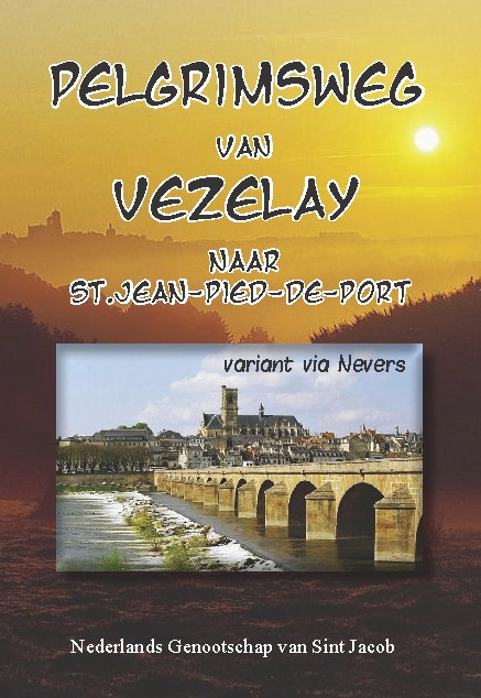
- Wandelgids Pelgrimsweg van Vezelay naar St.Jean-pied-de-Port via Nevers | Nederlands Genootschap van Sint Jacob
- Opvallende goede gids van dit deel van de St. Jacobsroute: men heeft goed kaartmateriaal gebruikt waar de route keurig op staat ingetekend. Ook een uitgebreide beschrijving ontbreekt niet .... alleen jammer dat het niet met een ringband is uitgevoerd. Deze gids beschrijft de route vanaf Vézelay tot St.Jean-Pied-de-Port en is gebaseerd op de... Read more
Maps

United Kingdom
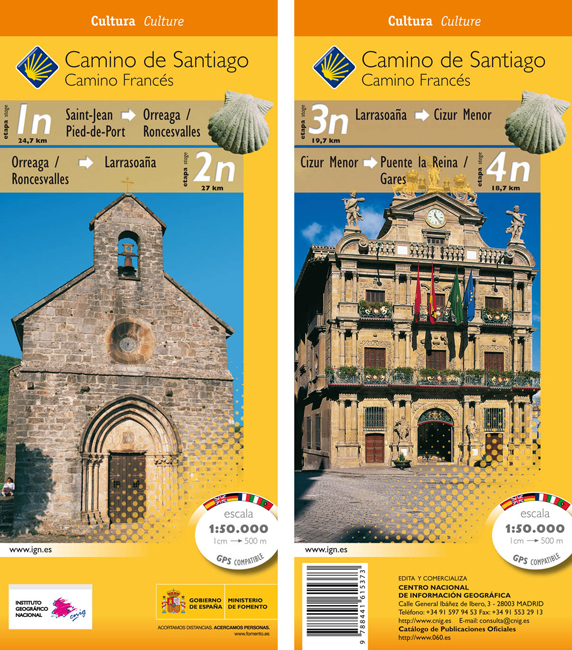
- Camino de Santiago: Stages 1n/2n/3n/4n, Saint-Jean-Pied-de-Port/Puente la Reina 50K CNIG Map
- The Way of St James: Stages 1n/2n/3n/4n, Saint-Jean-Pied-de-Port/Puente la Reina, in a series of double-sided topographic maps at 1:50,000 from the Spanish civilian survey organization, overprinted with the route and sights, plus information of accommodation and other facilities, route profiles, etc.Each 1:50,000 map is double-sided and has... Read more
- Also available from:
- De Zwerver, Netherlands
Netherlands
- Wandelkaart 1n-4n Camino Santiago de Compostella St-Jean - Puente Reina | CNIG - Instituto Geográfico Nacional
- The Way of St James: Stages 1n/2n/3n/4n, Saint-Jean-Pied-de-Port/Puente la Reina, in a series of double-sided topographic maps at 1:50,000 from the Spanish civilian survey organization, overprinted with the route and sights, plus information of accommodation and other facilities, route profiles, etc.Each 1:50,000 map is double-sided and has... Read more